Wearable Sensors vs. Drone-Based Monitoring: A 2025 Comparative Analysis for Precision Agriculture
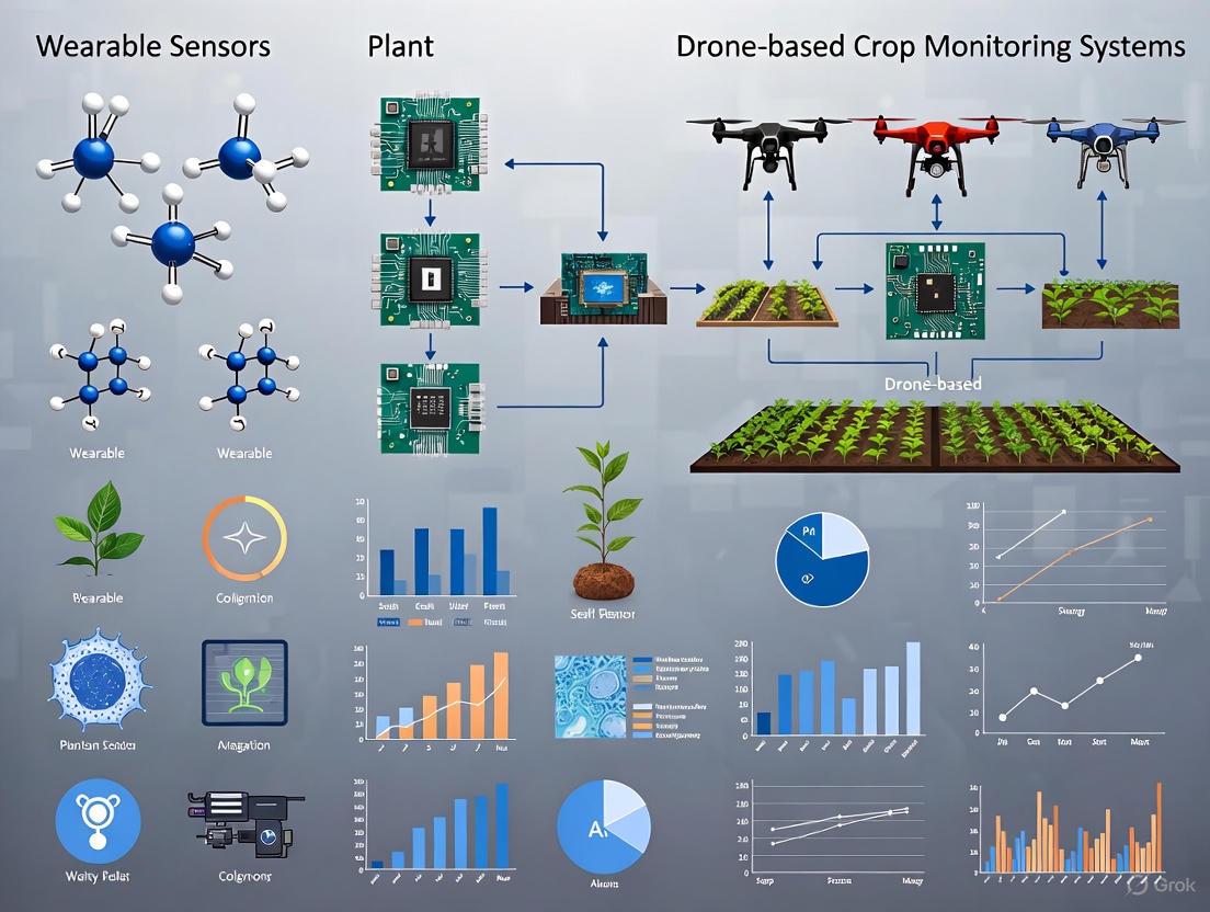
This article provides a comprehensive comparative analysis for researchers and agricultural scientists on two transformative crop monitoring technologies: wearable sensors and drone-based systems.
Wearable Sensors vs. Drone-Based Monitoring: A 2025 Comparative Analysis for Precision Agriculture
Abstract
This article provides a comprehensive comparative analysis for researchers and agricultural scientists on two transformative crop monitoring technologies: wearable sensors and drone-based systems. It explores the foundational principles of both approaches, detailing how flexible, biocompatible wearable devices enable direct, continuous measurement of plant physiology and chemistry, while aerial drones equipped with multispectral and AI-powered analytics facilitate large-scale field assessment. The analysis delves into specific methodological applications, from monitoring plant volatiles and stem diameter to generating NDVI maps and targeted spraying. It further addresses critical troubleshooting aspects, including sensor durability, data integration, and regulatory hurdles. A direct validation and comparison of spatial resolution, data types, cost-effectiveness, and suitability for different research and farming scales is presented, concluding with a synthesis of their complementary roles and future trajectories in smart, sustainable agriculture.
Understanding the Core Technologies: From Plant-Level Wearables to Field-Scale Drones
Wearable plant sensors represent a groundbreaking frontier in precision agriculture, enabling real-time, non-invasive monitoring of plant physiological status. Defined as flexible electronic devices that conform intimately to plant surfaces, these sensors leverage advanced materials and sensing mechanisms to continuously track vital signs, from water relations and growth to chemical biomarkers [1] [2]. This capability marks a paradigm shift from reactive to proactive crop management, allowing researchers and farmers to optimize plant health with unprecedented precision. The World Economic Forum has recognized this transformative potential, selecting wearable plant sensors as one of the Top 10 Emerging Technologies in 2023 [3].
This review provides a comparative analysis between wearable plant sensors and established drone-based monitoring systems, focusing on their underlying principles, operational capabilities, and experimental applications. While drone technology offers macro-scale field assessment through aerial imaging, wearable sensors provide direct, continuous physiological monitoring at the micro-scale [4] [5]. This distinction is fundamental to understanding their complementary roles in modern agricultural research and practice, particularly as global agricultural systems face increasing pressure from population growth and climate change [6] [2].
Fundamental Principles and Material Foundations
Core Operating Principles of Flexible Electronics
Wearable plant sensors operate on transduction principles that convert physiological parameters into quantifiable electrical signals. The fundamental mechanisms include:
- Piezoresistive Effect: Materials change electrical resistance in response to mechanical strain, enabling monitoring of plant growth and movement [5] [7]. This principle is particularly valuable for tracking stem diameter variations that indicate water status.
- Electrochemical Sensing: Selective detection of ions, nutrients, and biomarkers through redox reactions at electrode interfaces [3]. This enables real-time monitoring of soil nutrient levels, pesticide residues, and stress biomarkers.
- Capacitive Sensing: Measurement of dielectric property changes in response to humidity, vapor, or proximity [8]. This mechanism is widely employed in flexible humidity sensors for monitoring leaf surface microclimates.
- Potentiometric Sensing: Measurement of potential differences at electrode surfaces in response to specific ions or chemical species [9]. This allows for simultaneous measurement of multiple elements in nutrient solutions.
Biocompatible Materials for Plant Integration
The development of effective plant wearables requires materials that balance electronic performance with biocompatibility and environmental resilience:
Table 1: Key Material Classes for Wearable Plant Sensors
| Material Class | Specific Examples | Key Properties | Primary Applications |
|---|---|---|---|
| Carbon-Based Materials | Carbonized silk georgette, Graphene, CNTs [5] [8] | High conductivity, stretchability, biocompatibility | Strain sensing, electrophysiological monitoring |
| Polymeric Substrates | PDMS, Ecoflex, Polyimide (PI), PET [7] [8] | Flexibility, stretchability, environmental protection | Sensor encapsulation and structural support |
| Conductive Polymers | PEDOT:PSS, PANI [8] | Tunable conductivity, mechanical flexibility | Electrodes, chemical sensing |
| 2D Materials | MXenes [8] | High surface area, hydrophilic properties | Humidity sensing, gas detection |
| Metal-Based | Gold nanoparticles, Silver paste electrodes [7] [8] | High conductivity, electrochemical stability | Electrodes, electrochemical sensing |
These materials enable the creation of devices that can conform to complex plant morphologies without impeding growth or causing damage—a critical consideration for long-term monitoring applications. Material selection directly influences key performance parameters including sensitivity, detection range, and durability in harsh agricultural environments [6] [8].
Experimental Methodologies for Sensor Development and Deployment
Prototype Fabrication and Performance Characterization
Rigorous experimental protocols are essential for developing reliable wearable plant sensors. Standard methodologies include:
Sensor Fabrication: For resistive strain sensors, a common approach involves laser patterning of carbonized silk georgette on polyimide substrates, followed by encapsulation with biocompatible silicone elastomers [5]. Electrochemical sensors typically employ screen-printed electrodes fabricated with carbon or noble metal inks (e.g., silver paste) on flexible substrates [9] [8].
Performance Validation: Laboratory characterization includes mechanical cycling tests (e.g., ≥10,000 bending cycles) to verify durability, and environmental exposure tests to assess stability under varying temperature and humidity conditions [7]. Calibration against reference instruments establishes measurement accuracy, with statistical analysis of sensitivity, linearity, and detection limits [5] [8].
Plant Integration Studies: Controlled experiments monitor plant physiological responses post-sensor attachment, assessing potential impacts on growth, gas exchange, and development over full growth cycles [5] [2].
Field Deployment and Data Acquisition Protocols
Successful translation from laboratory to field settings requires standardized deployment methodologies:
Sensor Attachment: Gentle mounting using biocompatible adhesives or mechanical fixtures that minimize restriction of plant growth [5]. Orientation is optimized for target parameter measurement while minimizing interference with natural plant functions.
Data Acquisition Systems: Implementation of wireless nodes (e.g., Bluetooth, LoRaWAN) for continuous data logging with minimal power requirements [9] [6]. Timing protocols synchronize multi-sensor measurements across plant populations.
Environmental Correlation: Simultaneous monitoring of microclimatic conditions (temperature, humidity, light intensity) enables correlation between plant physiological responses and environmental drivers [5] [2].
The experimental workflow below illustrates the complete process from sensor development to data application:
Comparative Performance Analysis: Wearable Sensors vs. Drone-Based Monitoring
Technical Capabilities and Operational Parameters
Direct comparison of wearable plant sensors and drone-based systems reveals distinct advantages and limitations for each technology:
Table 2: Performance Comparison: Wearable Sensors vs. Drone-Based Monitoring
| Parameter | Wearable Plant Sensors | Drone-Based Monitoring |
|---|---|---|
| Spatial Resolution | Millimeter to centimeter scale [5] | Centimeter to meter scale [4] [10] |
| Temporal Resolution | Continuous, real-time (seconds to minutes) [1] [2] | Periodic (hours to days) [4] [10] |
| Measured Parameters | Direct physiological metrics: sap flow, stem diameter, nutrient uptake, VOC emissions [5] [3] | Indirect proxies: canopy vegetation indices, surface temperature, chlorophyll fluorescence [4] [10] |
| Detection Capability | Early stress detection (pre-visual) through physiological changes [5] [3] | Stress detection once visible symptoms manifest [4] |
| Plant Interaction | Direct physical contact with plant organs [1] [2] | Remote, non-contact sensing [4] [10] |
| Scalability | Limited by sensor cost and deployment labor [6] | Highly scalable for large acreages [4] [10] |
| Implementation Cost | High per-unit cost, potential for reuse [6] | High initial investment, lower marginal cost for additional acres [10] |
Complementary Applications in Precision Agriculture
The comparative analysis reveals how these technologies address different needs within agricultural research and management:
Wearable sensors excel in detailed physiological studies, such as investigating hydraulic mechanisms in fruit cracking [5] or quantifying stomatal sensitivity to soil drought [5]. Their continuous data streams enable discovery of novel plant behaviors and gene functions, as demonstrated in research linking circadian clock genes to stomatal regulation [5].
Drone systems provide unmatched efficiency for field-scale assessment, enabling rapid identification of spatial variability in crop health, soil conditions, and irrigation efficacy across hundreds of acres [4] [10]. Their macro-perspective is invaluable for whole-field management decisions and targeted scouting.
The integration framework below illustrates how these complementary technologies can be combined in agricultural research:
Essential Research Reagent Solutions and Materials
Successful implementation of wearable plant sensing requires specific materials and reagents optimized for plant biological interfaces:
Table 3: Essential Research Reagents and Materials for Wearable Plant Sensors
| Material/Reagent | Function | Application Example |
|---|---|---|
| Carbonized Silk Georgette | Strain-sensing material with high stretchability and durability [5] | PlantRing system for monitoring stem diameter variations [5] |
| Amine-terminated PAMAM Dendrimer-Gold Nanoparticles | Humidity-sensitive composite for impedance-based sensing [8] | Flexible humidity sensors on PET substrates [8] |
| Screen-printable Electrode Inks (Carbon, Silver) | Create conductive patterns on flexible substrates [9] [8] | Electrochemical sensors for nutrient detection [9] |
| Polydimethylsiloxane (PDMS) | Flexible, gas-permeable encapsulation material [7] [8] | Protective coating for field-deployable sensors [8] |
| Ion-Selective Membranes | Enable potentiometric detection of specific ions [9] | Multi-ion sensors for root zone monitoring [9] |
| Biocompatible Adhesives | Secure sensor attachment without plant damage [5] [2] | Mounting sensors to stems and leaves long-term [5] |
Wearable plant sensors and drone-based monitoring represent complementary rather than competing technologies in the precision agriculture ecosystem. Wearable sensors provide unprecedented access to plant physiological processes at high temporal resolution, enabling fundamental discoveries and plant-centered irrigation control [5]. Meanwhile, drone systems offer scalable solutions for field-level assessment and management [4] [10].
The future of agricultural monitoring lies in integrated systems that combine the micro-scale precision of wearable sensors with the macro-scale perspective of drone-based remote sensing. Such integration will require advances in data fusion algorithms, wireless communication networks, and multi-scale modeling approaches. As materials science continues to develop more robust, biocompatible, and cost-effective sensing platforms [6] [8], and as artificial intelligence enhances data interpretation capabilities [4], these technologies will collectively transform our approach to crop management, breeding programs, and sustainable agricultural intensification.
Wearable sensors and drone-based crop monitoring represent two advanced, yet functionally distinct, sensing paradigms. Wearable sensors are engineered for intimate, continuous contact with a biological host—either human or livestock—to monitor internal physiological and biochemical states in real-time [11] [12]. In contrast, agricultural drones operate as remote, macroscopic platforms, capturing spatial and spectral data across vast areas of crops and environment from above [13] [14]. This comparative analysis delineates their core functions, data types, and underlying technological principles, providing a framework for researchers and scientists to evaluate their applications in healthcare and precision agriculture.
Table 1: Fundamental Comparison of Sensing Paradigms
| Feature | Wearable Sensors | Drone-Based Crop Monitoring |
|---|---|---|
| Primary Domain | Healthcare, Livestock Management | Precision Agriculture |
| Sensing Distance | Intimate/Contact-based | Remote/Macroscopic |
| Temporal Resolution | Continuous, Real-time | Periodic, Snapshot |
| Spatial Resolution | Individual Organ/Body System | Field, Plant, or Leaf Level |
| Core Data Types | Physiological, Biochemical, Environmental | Spectral, Spatial, Topographic |
| Key Outputs | Heart rate, glucose, temperature | Vegetation indices, health maps, yield predictions |
Core Functions & Data Types of Wearable Sensors
Wearable sensors function as a non-invasive "eyesight" into the body, capturing a multifaceted stream of data directly from the host [11] [12]. Their functionality is categorized into three primary domains.
Monitoring Physiological Signals
These sensors capture physical and electrical signals generated by the body's functional activities, crucial for health management and preventive medicine [11].
- Electrophysiological Signals: These include electrocardiogram (ECG) for cardiac electrical activity, electromyogram (EMG) for skeletal muscle contraction, and electroencephalogram (EEG) for neural activity in the brain. They are vital for diagnosing cardiovascular pathologies, assessing neuromuscular health, and detecting neurological conditions like epilepsy [11].
- Biomechanical Signals: These are generated by musculoskeletal kinematics, such as motion, strain, and pressure, and are commonly measured by accelerometers and gyroscopes for activity and gait analysis [11] [15].
- Supplementary Biophysical Indicators: This category includes core metrics like body temperature and respiratory rate, which are fundamental indicators of metabolic state and overall health [11].
Sensing Biochemical Markers
Wearable biosensors incorporate biorecognition elements to selectively detect and quantify chemical biomarkers in bodily fluids, providing molecular-level health insights [12].
- Target Analytes: Key biomarkers include glucose (for diabetes management), lactate (for muscle fatigue), electrolytes, and pH levels [11] [12].
- Biofluid Sources: These sensors are designed to analyze sweat, saliva, tears, and interstitial fluid, enabling non-invasive monitoring [12]. Sweat, with its rich biochemical composition, is a particularly excellent medium for this purpose [12].
Tracking Environmental Parameters
Wearables also monitor the user's immediate ambient environment, contextualizing physiological and biochemical data.
- Common Metrics: Devices can track exposure to factors like ambient temperature, humidity, and airborne pollutants, providing a more complete picture of the factors influencing an individual's health [15].
Table 2: Core Data Types and Specifications of Wearable Sensors
| Data Category | Specific Signals/Markers | Example Sensing Modality | Typical Device/Platform |
|---|---|---|---|
| Physiological | ECG, EMG, EEG, EOG | Conductive electrodes (e.g., MXene, Hydrogel) | Smart patches, Chest straps |
| Heart Rate, Blood Pressure | Photoplethysmography (PPG) | Smartwatches, Fitness bands | |
| Motion, Strain, Pressure | Accelerometer, Gyroscope, Piezoresistive sensors | All-in-one wearables | |
| Skin Temperature | Thermistor | Smart patches, Rings | |
| Biochemical | Glucose, Lactate | Enzyme-based electrochemical sensors | Smart patches, Textile sensors |
| Electrolytes (e.g., Na+, K+) | Ion-selective electrodes (ISEs) | Textile sensors | |
| pH | Potentiometric sensors | Smart patches | |
| Environmental | Ambient Temperature, Humidity | Integrated environmental sensors | Smartwatches |
Core Functions & Data Types of Agricultural Drones
Agricultural drones perform two primary types of tasks: mechanical and informational [13]. This analysis focuses on their informational and sensing capabilities, which involve mapping, monitoring, and generating data to assess crop and field conditions.
Informational & Remote Sensing Functions
Drones serve as aerial platforms for a suite of remote sensing technologies.
- Field & Crop Mapping: Using high-resolution cameras, drones create detailed maps of field topography, boundaries, and plant populations [13].
- Crop Health Assessment: This is a primary function. Equipped with multispectral and hyperspectral sensors, drones capture data beyond visible light to compute vegetation indices like the Normalized Difference Vegetation Index (NDVI), which reveals plant vigor, chlorophyll levels, and photosynthetic activity [14] [16].
- Stress & Pathogen Detection: Advanced AI-powered diagnostics can spot diseases, nutrient deficiencies, and pest infestations by analyzing subtle changes in crop canopy reflectance [14] [17].
- Sustainability Monitoring: Emerging applications include tracking soil carbon levels and monitoring regenerative practices for carbon credit verification [14].
Key Data Outputs
The raw sensor data is processed into actionable insights for precision farming.
- Vegetation Indices: Quantified metrics of plant health (e.g., NDVI) [16].
- Health Zonation Maps: Georeferenced maps that highlight areas of stress, disease, or poor growth within a field, enabling targeted intervention [17].
- Yield Predictions: Data-driven forecasts of crop production [16].
- Treatment Prescription Files: Zoned maps that can be exported to guide variable-rate application of water, fertilizer, or pesticides by other farm machinery [17].
Table 3: Core Data Types and Specifications of Agri-Drone Monitoring
| Data Category | Specific Applications | Sensing Technology | Key Outputs |
|---|---|---|---|
| Spatial & Topographic | Field mapping, 3D modeling | RGB Cameras, LiDAR | Field maps, elevation models |
| Spectral & Health | Crop vigor, chlorophyll content | Multispectral, Hyperspectral sensors | NDVI, other vegetation indices |
| Disease, pest, nutrient deficiency | AI-powered analysis of spectral data | Health alerts, zonation maps | |
| Plant-level imaging | 4th-gen multispectral imaging | Targeted treatment maps | |
| Environmental | Soil moisture, carbon monitoring | Advanced specialized sensors | Sustainability insights, carbon data |
Experimental Protocols & Methodologies
The validation of performance for these technologies relies on distinct experimental protocols, tailored to their specific operational environments.
Experimental Protocol for Wearable Biosensor Development
The following methodology outlines the development and benchtop validation of a typical hydrogel-based electrochemical biosensor for sweat analysis [11] [12].
- Sensor Fabrication:
- Substrate Preparation: A flexible polymer (e.g., Polydimethylsiloxane (PDMS)) or textile is selected as the substrate.
- Electrode Patterning: Conductive inks (e.g., Carbon, Silver/Silver Chloride) are screen-printed or deposited via spray-coating to form working, reference, and counter electrodes.
- Functionalization: The working electrode is modified with a biorecognition element (e.g., Glucose Oxidase for glucose sensing). A hydrogel layer (e.g., Gelatin-based, Polyvinyl alcohol (PVA)) may be added to enhance biocompatibility and fluid wicking.
- In-Vitro Calibration:
- The sensor is exposed to a series of standard solutions with known concentrations of the target analyte (e.g., 0-10 mM glucose).
- The electrochemical response (e.g., amperometric current) is measured using a potentiostat.
- A calibration curve (Response vs. Concentration) is plotted to determine key performance metrics: sensitivity, linear detection range, and limit of detection (LOD).
- Mechanical Testing: The sensor's flexibility and durability are tested under repeated bending cycles (e.g., 1000 cycles at a 5mm bend radius) while monitoring for signal drift or physical degradation.
- Selectivity Assessment: The sensor's response is tested against common interfering agents (e.g., Ascorbic acid, Uric acid for glucose sensors) to confirm specificity.
Experimental Protocol for Drone-Based Crop Health Assessment
This protocol describes the workflow for generating an AI-powered crop health zonation map [14] [17].
- Mission Planning:
- A flight plan is programmed into the drone's ground control software, defining the area, flight altitude, and image overlap (e.g., 80% front and side overlap).
- The appropriate sensors (e.g., multispectral camera) are mounted and calibrated on the drone.
- Data Acquisition:
- The autonomous flight is executed, ensuring consistent lighting conditions (e.g., near solar noon).
- The drone captures geotagged imagery across multiple spectral bands (e.g., Red, Green, Red-Edge, Near-Infrared).
- Data Processing:
- Orthomosaic Generation: Captured images are stitched together using photogrammetry software to create a single, georeferenced map for each spectral band.
- Index Calculation: Vegetation indices (e.g., NDVI) are computed pixel-by-pixel using the formula: NDVI = (NIR - Red) / (NIR + Red).
- AI-Powered Analysis & Zonation:
- The computed index map is processed by a trained machine learning model. This model, often trained on a dataset of annotated crop images, classifies areas as "healthy," "stressed," or "diseased" [17].
- The output is a color-coded health zonation map, which can be converted into a prescription file for variable-rate application systems.
Signaling Pathways, Workflows & Logical Diagrams
The operational logic of both sensing systems can be visualized through their core workflows.
Wearable Biosensor Signaling Pathway
The following diagram illustrates the transduction pathway from a biological event to a measurable digital signal in a wearable biosensor.
Drone-Based Crop Monitoring Workflow
This workflow outlines the logical sequence from mission planning to actionable insight in precision agriculture.
The Scientist's Toolkit: Research Reagent Solutions
The development and operation of these technologies rely on specialized materials and software tools.
Table 4: Essential Research Tools for Sensor Development and Deployment
| Category | Item | Function & Application |
|---|---|---|
| Advanced Materials for Wearables | MXenes (e.g., Ti₃C₂Tₓ) | Provide ultrahigh electrical conductivity and specific surface area for sensitive electrophysiological and biochemical electrodes [11]. |
| Conductive Polymers (e.g., PEDOT:PSS) | Used as flexible, conductive coatings for electrodes and interconnects in flexible sensors [11]. | |
| Hydrogels (e.g., Gelatin, PVA) | Biocompatible, hydrating interfaces that mimic biological tissues, ideal for in vivo monitoring and enhancing contact with skin [11] [12]. | |
| Gold Nanowires | Create highly conductive and stretchable networks within flexible substrates for durable sensors [12]. | |
| Drone Sensing & Analysis | Multispectral/Hyperspectral Sensors | Capture light reflectance data at specific wavelengths (e.g., Red, NIR) essential for calculating vegetation indices like NDVI [14] [16]. |
| AI-Powered Analytics Platforms (e.g., DroneDeploy) | Process aerial imagery to identify patterns of disease, stress, and nutrient deficiency, providing real-time crop diagnostics [14]. | |
| Ground Control Points (GCPs) | Physical markers placed in the field to geometrically correct and improve the spatial accuracy of stitched drone imagery. | |
| General Research Equipment | Potentiostat/Galvanostat | An essential electronic instrument for performing electrochemical measurements (e.g., amperometry, impedance) in biosensor development and testing. |
| Phantom Limb/Skin Simulants | Synthetic platforms that mimic the mechanical and electrical properties of human tissue for controlled testing of wearable sensor performance. |
Agricultural drones, or Unmanned Aerial Vehicles (UAVs), are sophisticated technological platforms that integrate an airframe (platform) with data collection sensors and onboard intelligence to enable precision farming. Within the broader comparative analysis of plant monitoring technologies, they offer a distinct, aerial-based solution contrasted with ground-based or wearable sensor approaches [1]. Their core function is to provide high-resolution, spatially explicit data for informed crop management.
Drone Platforms: Structural and Functional Categories
The platform defines the drone's physical structure and flight capabilities, determining its suitability for different agricultural tasks and farm scales. The three primary categories are fixed-wing, multirotor, and Vertical Takeoff and Landing (VTOL), each with distinct advantages and limitations [18].
Table 1: Comparative Analysis of Agricultural Drone Platform Types.
| Platform Type | Key Advantages | Key Limitations | Ideal Use Cases |
|---|---|---|---|
| Fixed-Wing | Long flight times; Efficient coverage of large areas; Better performance in windy conditions [18]. | Cannot hover; Requires runway for takeoff/landing; Lower maneuverability [18]. | Large-scale mapping and surveying of extensive farmland [18]. |
| Multirotor | High maneuverability; Ability to hover and fly at low altitudes; Vertical Takeoff and Landing (VTOL) [18]. | Shorter flight times; Limited to smaller or medium-sized fields [18]. | Close-range crop inspection, precision spraying on complex plots [18]. |
| VTOL | Versatile VTOL capability; No need for a runway; Efficient long-distance coverage [18]. | More complex operation and maintenance; Higher cost due to hybrid design [18]. | Farms with varied topography and mixed requirements for close inspection and large-area coverage [18]. |
Sensor Technologies for Data Acquisition
Sensors are the primary data-gathering components of a drone system. The choice of sensor dictates the type of information that can be extracted about the crop and its environment [19]. These can be broadly categorized into four types.
Table 2: Overview of Primary Sensor Types Used in Agricultural Drones.
| Sensor Type | Spectral Bands | Measured Parameters / Applications | Relative Cost |
|---|---|---|---|
| Visual (RGB) | Red, Green, Blue [19] | True-color imagery for field observation, plant counting, and visual assessment [19]. | Low [19] |
| Multispectral | Typically includes B, G, R, Red Edge, Near-Infrared (NIR) [19] | Plant health assessment (e.g., NDVI), chlorophyll levels, nutrient deficiency, and biomass estimation [19] [20]. | Medium [19] |
| Thermal Infrared | Long-wave infrared [19] | Crop water stress, irrigation scheduling, and detection of waterlogging [19] [20]. | High [19] |
| LiDAR | Active laser pulses [21] | Creation of 3D point clouds for topographic mapping, canopy structure, and volume estimation [21]. | High |
Experimental Data: Sensor Performance in Estimating Grapevine Parameters
A 2024 study provides a direct, quantitative comparison of how different UAV sensors perform against a terrestrial benchmark (Terrestrial Laser Scanner - TLS) for estimating geometric parameters of grapevines, a key metric of plant vigor [21]. This experimental data is crucial for selecting the appropriate sensor for a specific research goal.
Experimental Protocol:
- Objective: To compare the accuracy of point cloud data from a TLS and various UAV sensors (RGB, LiDAR, multispectral, panchromatic, Thermal Infrared) in estimating grapevine height, projected area, and volume [21].
- Methodology: Data was collected from a 0.30-hectare experimental vineyard. The TLS and UAV systems were used to scan the grapevines, generating 3D point clouds. Maximum grapevine height was manually measured in the field for validation, and canopy projected area was measured in a GIS [21].
- Data Analysis: The accuracy of each sensor was evaluated using linear correlations (r and R²) and the Root Mean Square Error (RMSE) between the sensor-derived parameters and the reference measurements [21].
Table 3: Sensor Performance in Estimating Grapevine Geometric Parameters (Adapted from [21])
| Sensor Type | Max Height vs. Measured (r / R² / RMSE in m) | Projected Area in GIS (r / R² / RMSE in m²) | Performance Summary |
|---|---|---|---|
| TLS (Benchmark) | 0.95 / 0.90 / 0.027 [21] | N/A | Highest accuracy for height estimation [21]. |
| UAV Panchromatic | >0.83 / >0.70 / <0.084 [21] | >0.83 / >0.70 / <0.084 [21] | Performed well, closely matching TLS and measured values [21]. |
| UAV RGB | >0.83 / >0.70 / <0.084 [21] | >0.83 / >0.70 / <0.084 [21] | Performed well, closely matching TLS and measured values [21]. |
| UAV Multispectral | >0.83 / >0.70 / <0.084 [21] | >0.83 / >0.70 / <0.084 [21] | Performed well, closely matching TLS and measured values [21]. |
| UAV LiDAR | >0.83 / >0.70 / <0.084 [21] | >0.83 / >0.70 / <0.084 [21] | Performed well, closely matching TLS and measured values [21]. |
| UAV Thermal (TIR) | 0.76 / 0.58 / 0.147 [21] | 0.82 / 0.66 / 0.165 [21] | Poor performance in estimating geometric parameters [21]. |
Onboard Intelligence: AI and Autonomous Systems
Onboard intelligence transforms drones from simple data collectors to automated field analysis tools. This encompasses the computing hardware and algorithms that enable real-time data processing, autonomous flight, and targeted action [20] [14].
The core of this intelligence is Artificial Intelligence (AI), particularly machine learning models trained on thousands of plant images. These models can detect early signs of pests, diseases, nutrient deficiencies, and water stress during the flight itself, a process known as edge computing [20]. This allows for immediate diagnosis and shortens response time dramatically.
This AI-driven analysis enables fully automated and precise mechanical tasks. For example, spray-equipped drones can use AI-generated zonal maps to identify affected patches and autonomously adjust nozzle flow and spray volume based on real-time crop density, ensuring inputs are applied only where needed [20]. Advanced systems now feature AI-powered drone swarms, where fleets of drones coordinate to spray, monitor, or map massive areas simultaneously [14].
The Researcher's Toolkit for Drone-Based Crop Monitoring
Implementing a drone-based monitoring study requires a suite of hardware, software, and analytical tools. The following table details key components and their functions in a typical research workflow.
Table 4: Essential Research Toolkit for Drone-Based Crop Monitoring.
| Tool / Reagent | Category | Primary Function in Research |
|---|---|---|
| VTOL Drone Platform | Hardware | Provides the aerial vehicle for data collection; VTOL capability is versatile for complex terrain [18]. |
| Multispectral Sensor | Hardware | Captures data in non-visible wavelengths (e.g., NIR, Red Edge) for calculating vegetation indices like NDVI [19] [20]. |
| Terrestrial Laser Scanner | Hardware | Serves as a high-accuracy ground truthing instrument for validating drone-based geometric measurements [21]. |
| Ground Control Points | Equipment | Physical markers placed in the field to geometrically correct and improve the spatial accuracy of drone imagery. |
| Flight Planning Software | Software | Enables autonomous mission planning, defining flight paths, altitude, overlap, and sensor triggering [22]. |
| Photogrammetry Software | Software | Processes hundreds of overlapping drone images to generate orthomosaics, digital elevation models, and 3D point clouds [21]. |
| Normalized Difference Vegetation Index | Analytical | A key vegetation index calculated from multispectral data to assess plant health and density [19]. |
Comparative Positioning: Drones vs. Wearable Sensors
Positioning drone-based monitoring within the broader context of plant sensing reveals its complementary role alongside other technologies, such as wearable plant sensors. The following diagram illustrates this technological relationship.
As shown, drone-based systems are defined by their platform versatility, sophisticated multi-sensor payloads, and increasingly autonomous onboard intelligence. They provide a powerful, spatially explicit solution for crop monitoring that is highly complementary to the continuous, micro-scale data from wearable sensors, together enabling a multi-scale understanding of plant health.
Drone technology has become a pivotal tool in modern agricultural research, enabling high-throughput, non-destructive data collection and intervention. This guide provides a comparative analysis of its three core functions—large-scale mapping, precision spraying, and phenotypic analysis—contrasting their capabilities with ground-based alternatives like wearable plant sensors to highlight distinct applications and performance.
Large-Scale Mapping and Field Analysis
Large-scale mapping with drones provides researchers with high-resolution, georeferenced maps of experimental plots, enabling the detailed analysis of spatial variability in crop health, soil conditions, and resource distribution.
Key Applications and Technologies: Drones equipped with RGB, multispectral, and thermal sensors can rapidly survey hundreds of acres, capturing data that is processed into various analytical maps [22] [23]. Normalized Difference Vegetation Index (NDVI) maps, derived from multispectral imagery, are crucial for assessing crop vigor and health status [24] [23]. Furthermore, drones are employed for automated field mapping and soil analysis, measuring moisture and nutrient levels to optimize resource management [22].
Comparative Performance Data: The table below summarizes the performance and adoption of mapping technologies.
Table 1: Comparative Analysis of Field Mapping Technologies
| Technology | Key Applications | Spatial Resolution | Coverage Speed | Estimated Adoption in 2025 [22] | Cost per Acre (Mapping) [22] |
|---|---|---|---|---|---|
| Drone-based Mapping | NDVI mapping, soil analysis, growth tracking, irrigation planning [22] [23] | High (Centimeter-level) [14] | Hundreds of acres per flight [23] | 52% | $5 - $11 |
| Satellite Imaging | Regional crop health assessment, large-area monitoring [22] | Low (Meter-level) | Global coverage | N/A | Lower (often subscription-based) |
| Wearable Plant Sensors | In-situ monitoring of sap flow, leaf temperature, and micro-climate [25] | Single plant level | Manual deployment per plant | Emerging | N/A |
Experimental Protocol for Drone-Based Mapping: A typical research protocol for generating field maps involves [24]:
- Flight Planning: Define the area of interest and set a flight path with high image overlap (e.g., 80% forward and side overlap) to ensure complete coverage.
- Ground Control: Place ground control points (GCPs) with known GPS coordinates in the field to achieve high geolocation accuracy (within 2 cm).
- Data Acquisition: Execute the autonomous flight using a drone equipped with a multispectral camera. Flights are often conducted at altitudes of 50-120 meters under clear, cloudless skies for consistent illumination.
- Data Processing: Use photogrammetry software (e.g., Agisoft Metashape) to align images and generate geo-referenced orthomosaics and digital surface models (DSMs).
- Radiometric Calibration: Convert raw sensor data to reflectance values using a reference panel with known reflectance properties imaged during the flight [24].
- Analysis: The orthomosaic is processed with scripts (e.g., in R) to calculate vegetation indices like NDVI for every plot, segment plant pixels from soil, and extract plot-level mean reflectance values [24].
Diagram 1: Drone-based mapping and analysis workflow.
Precision Spraying and Targeted Application
Precision spraying with drones allows for the site-specific application of agrochemicals, revolutionizing pest control and nutrient management by targeting only areas requiring intervention.
Key Applications and Technologies: Spray drones use AI and sensor-driven tanks to apply pesticides, herbicides, and fertilizers with pinpoint accuracy [22]. A major application is drone-based weed mapping for targeted spraying [26]. Drones first map the field to identify weed patches, then generate a prescription map that is executed by a sprayer (either drone or ground-based), targeting only the infested zones.
Comparative Performance Data: The table below compares the efficacy of targeted spraying versus broadcast methods.
Table 2: Experimental Results from Targeted Spraying Trials
| Parameter | Broadcast Application (Control) | Targeted Spraying (Drone-Based) | Notes/Source |
|---|---|---|---|
| Herbicide Savings | 0% (Baseline) | ~50% | Iowa State University demonstration on soybeans [26]. |
| Cost Savings per Acre | N/A | $13.42 | From reduced chemical use [26]. |
| Weed Control Efficacy | Baseline | >99% herbicide injury; 94% weeds dead [26] | No significant difference in final yield compared to control [26]. |
| Weed Detection Accuracy | N/A | 94% | Sentera Aerial WeedScout program (2024 data) [26]. |
| Adoption Rate in 2025 | N/A | 55% | Projected for precision spraying applications [22]. |
Experimental Protocol for Targeted Weed Spraying: A demonstrated protocol for drone-based weed control is as follows [26]:
- High-Resolution Mapping: Fly a drone equipped with a high-precision camera over the field to capture detailed imagery of the weed pressure.
- Prescription Generation: Use automated analysis software (e.g., Sentera's Aerial WeedScout) to process the imagery, detect weeds as small as 1/4 inch, and automatically generate a targeted spray prescription map within 24 hours.
- Application: Upload the prescription file to a sprayer with nozzle control capabilities (e.g., a self-propelled sprayer or a spray drone). The sprayer then applies herbicide only to the predefined zones, optimizing tank mix and volume for the specific weed pressure.
- Validation: Conduct pre- and post-application weed counts in the treatment area to quantify control efficacy. Compare crop yield at harvest with a control area treated with broadcast application.
Phenotypic Analysis and Yield Prediction
Drones enable high-throughput field phenotyping (HTFP), using advanced sensors and artificial intelligence to quantitatively measure key plant traits and predict yield at scale.
Key Applications and Technologies: This function involves using drones to estimate agronomic traits like plant height, biomass, leaf area index (LAI), and, crucially, yield components [24] [27]. Advanced AI-powered systems, such as CropQuant-Air, combine deep learning models with multispectral and RGB imagery to detect and count wheat spikes—a key yield component—and perform yield classification [27]. This allows researchers to screen hundreds of varieties for stress tolerance and yield performance under complex field conditions.
Comparative Performance Data: The table below contrasts drone-based phenotyping with traditional manual methods.
Table 3: Comparison of Phenotypic Analysis Methods
| Trait / Metric | Traditional Manual Phenotyping | Drone-Based Phenotyping (AI-Powered) | Correlation with Manual Scoring |
|---|---|---|---|
| Spike Number per m² (SNpM2) | Laborious, prone to error [27] | Automated using optimized YOLOv7 model [27] | Significant positive correlation [27] |
| Plant Height & Biomass | Destructive sampling or manual measurements | Estimated via vegetation indices and DSM analysis [24] | Good correlation with LAI and biomass [24] |
| Throughput (plots per day) | Low (10s-100s) | High (1000s) | N/A |
| Scalability | Limited to small populations | Suitable for large-scale breeding trials [27] | N/A |
Experimental Protocol for AI-Powered Phenotypic Analysis (e.g., Wheat Spike Detection): The workflow for a system like CropQuant-Air involves [27]:
- Field Trial and Image Acquisition: Establish a field trial with hundreds of wheat varieties (e.g., 210 varieties with two replicates). Use a drone with an RGB camera to capture high-resolution canopy images during the reproductive growth stage.
- Plot Segmentation: Process the stitched orthomosaic of the entire field using a deep learning model (e.g., YOLACT-Plot) to automatically segment and delineate individual experimental plots.
- Spike Detection and Counting: Within each segmented plot, run an optimized object detection model (e.g., YOLOv7) that has been trained on a large dataset of labeled wheat spikes (including public datasets like the Global Wheat Head Detection dataset) to detect and count spikes.
- Trait Extraction and Yield Classification: Extract the spike density (SNpM2) and other canopy-level spectral and textural features. Use these computed traits as input to a machine learning classifier (e.g., XGBoost) to classify plots into different yield groups.
- Validation: Validate the system's accuracy by performing correlation analysis between the computationally derived traits (e.g., spike counts) and manually scored ground truth data.
Diagram 2: AI-powered phenotypic analysis workflow for yield prediction.
The Researcher's Toolkit: Essential Reagents and Solutions
For researchers designing experiments in drone-based agriculture and comparative monitoring, the following key resources and technologies are essential.
Table 4: Key Research Reagent Solutions for Drone-Based Agricultural Research
| Category / Solution | Specific Examples | Function in Research |
|---|---|---|
| Drone Platforms | DJI Agras T30 (spraying), Sentera (weed mapping), Parrot Bluegrass Fields (mapping) [23] | Physical vehicle for sensor and applicator deployment. |
| Sensor Packages | Multispectral (e.g., Airphen), Thermal (e.g., FLIR), RGB [24] | Captures raw data on crop reflectance, temperature, and morphology. |
| AI/Software Models | YOLOv7 (spike detection), Custom CNNs (disease detection), XGBoost (yield classification) [27] | Extracts meaningful phenotypic information from raw image data. |
| Data Processing Suites | Agisoft Metashape, Pix4D, FieldImageR package in R [24] [26] | Processes raw images into orthomosaics, DSMs, and extracts plot-level data. |
| Validation Benchmarks | Global Wheat Head Detection (GWHD) dataset [27] | Provides standardized data for training and benchmarking AI models. |
| Comparative Technology | Wearable Plant Sensors [25] | Provides in-situ, continuous data on plant physiology (e.g., sap flow, leaf temperature) for ground-truthing and complementary studies. |
Drone technology offers distinct capabilities in mapping, spraying, and phenotyping that are highly complementary to, rather than a direct replacement for, other monitoring technologies like wearable sensors. Wearable sensors excel at continuous, high-frequency monitoring of individual plant physiology [25], while drones provide a scalable, canopy-level overview. The integration of data from both platforms—detailed physiological data from wearables and scalable spatial data from drones—holds the promise of a more holistic understanding of plant-environment interactions, which is crucial for advancing breeding programs and developing sustainable agricultural practices.
Deployment in Action: Methodologies and Real-World Applications in Crop Monitoring
The pursuit of precision agriculture has given rise to two distinct technological paradigms for crop monitoring: wearable sensor technology and drone-based remote sensing. Wearable sensors, attached directly to plants, provide continuous, high-resolution physiological data at the individual plant level, enabling real-time detection of stresses before visible symptoms appear [28] [29]. In contrast, drone-based systems utilize aerial platforms equipped with advanced sensors to capture spatial and temporal data across entire fields, facilitating large-scale monitoring and management zones identification [4] [30]. This comparative analysis examines the technical capabilities, experimental methodologies, and research applications of these approaches within the specific context of measuring volatile organic compounds (VOCs), sap flow, stem microvariations, and microclimate parameters—critical indicators of plant health and stress response.
The integration of these technologies is driving a paradigm shift from reactive to proactive agriculture. Where traditional methods often rely on visual identification of stress symptoms, these advanced sensing platforms enable early intervention, potentially reducing crop losses and optimizing resource use [31] [29]. For researchers and agricultural professionals, understanding the comparative advantages, technical requirements, and data output of each approach is fundamental to designing effective monitoring strategies and advancing sustainable crop management practices.
Wearable Sensors for Plant Physiology Monitoring
Volatile Organic Compound (VOC) Sensing
2.1.1 Sensing Technologies and Materials
Wearable VOC sensors represent a cutting-edge application of materials science for plant health diagnostics. These sensors typically utilize chemiresistive or electrochemical sensing mechanisms, where exposure to target VOCs induces measurable changes in electrical properties [28]. Advanced sensing materials include metal oxide semiconductors (e.g., SnO₂, ZnO), conducting polymers (e.g., polyaniline, polypyrrole), and carbon nanomaterials (e.g., graphene, MXenes), which offer high sensitivity and low detection limits crucial for capturing subtle plant emissions [31] [28]. Recent innovations focus on developing flexible, biocompatible substrates that conform to plant surfaces without inhibiting growth or causing damage, with materials such as polydimethylsiloxane (PDMS) and biodegradable hydrogels gaining prominence for their mechanical properties and environmental sustainability [28] [29].
Plant-emitted VOCs serve as noninvasive biomarkers for tracking health and diagnosing diseases, with emission profiles changing significantly in response to both biotic and abiotic stresses [31]. For example, tomatoes infected with late blight release hexenal, while maize plants under insect attack emit increased methanol and terpenoids [31]. Monitoring these VOC signatures enables early detection of pathogens like Fusarium oxysporum and Ralstonia solanacearum, which can cause yield losses of up to 90% in tomato and potato crops [28].
Table 1: Key Plant VOC Biomarkers and Their Significance
| VOC Compound | Plant Source | Stimulant/Context | Significance |
|---|---|---|---|
| Methanol | Maize | Insect attack | General stress response indicator |
| Hexenal | Tomato | Late blight infection | Specific disease biomarker |
| Terpenoids | Corn seedlings | Insect herbivory | Direct and indirect defense response |
| Jasmonate | Corn | Mechanical damage | Defense hormone signaling |
| Monoterpene α-pinene | Pinus sylvestris | Mechanical damage, water stress | Abiotic stress indicator |
| (E)-β-caryophyllene | Maize (root) | Western corn rootworm infestation | Below-ground pest detection |
| Salicylic acid | Tobacco, soybean, potato, rice, cucumber | Biotic and abiotic stresses | Systemic acquired resistance |
2.1.2 Experimental Protocol for Wearable VOC Sensor Deployment
Objective: To continuously monitor stress-induced VOC emissions from tomato plants subjected to fungal pathogen (Fusarium oxysporum) inoculation.
Materials Required:
- Flexible chemiresistive VOC sensors (e.g., metal oxide semiconductor-based)
- Potentiostat for electrochemical measurements
- Data logging system with wireless transmission capability
- Reference analysis instrument (e.g., portable GC-MS for validation)
- Plant attachment materials (biocompatible adhesive, flexible straps)
- Pathogen culture and inoculation tools
- Environmental control chamber
Methodology:
- Sensor Calibration: Pre-deploy sensors in controlled atmosphere chambers with standard VOC solutions at known concentrations (0.1-100 ppm) to establish calibration curves for key biomarkers (e.g., hexenal, jasmonate) [28].
- Plant Preparation: Group tomato plants (n=20) into treatment (inoculated) and control groups. Maintain consistent growing conditions (25°C, 60% RH, 16/8h light/dark cycle).
- Sensor Attachment: Mount pre-calibrated sensors on fully expanded leaves using biocompatible attachment systems that minimize damage to plant tissues. Ensure proper sensor-leaf contact while allowing for natural growth.
- Pathogen Inoculation: Inoculate treatment plants with Fusarium oxysporum spore suspension (10⁶ spores/mL) applied to root zone. Control plants receive sterile water.
- Data Collection: Record continuous sensor measurements at 15-minute intervals for 14 days post-inoculation. Simultaneously collect microclimate data (temperature, humidity, light intensity).
- Validation Sampling: Conduct grab air sampling adjacent to sensor locations 2-3 times daily for GC-MS analysis to validate sensor accuracy.
- Data Analysis: Process time-series data to identify VOC emission patterns, correlating with disease progression visually assessed using standard disease rating scales.
This protocol enables real-time, non-invasive monitoring of plant stress responses, overcoming limitations of conventional VOC analysis techniques like GC-MS that lack continuous monitoring capability and require extensive sample preparation [31] [28].
Sap Flow, Stem Microvariations, and Microclimate Sensing
2.2.1 Sensing Approaches and Technical Specifications
Wearable sensors for monitoring plant hydrodynamics include dendrometers for stem microvariations and heat-based sensors for sap flow. These sensors provide critical insights into plant water relations, growth patterns, and responses to environmental stresses. Modern implementations utilize microelectromechanical systems (MEMS) technology with high-resolution strain gauges and temperature sensors that offer minimal intrusion while capturing diurnal variations in stem diameter and water flux [29]. Microclimate sensors concurrently monitor ambient conditions immediately surrounding the plant, including air temperature, relative humidity, light intensity, and leaf wetness, providing essential context for interpreting physiological data.
Table 2: Wearable Sensor Performance Specifications for Plant Physiology Monitoring
| Parameter | Sensor Technology | Accuracy/Resolution | Measurement Range | Key Applications |
|---|---|---|---|---|
| VOC Detection | Chemiresistive (Metal Oxide) | 0.1-5 ppm (detection limit) | 0.1-500 ppm | Early disease detection, stress response monitoring |
| VOC Detection | Electrochemical | 0.5-2 ppm (detection limit) | 0.5-1000 ppm | Specific biomarker detection (e.g., ethylene) |
| Stem Diameter | Resistive strain gauge | ±1µm resolution | 0-20 mm variation | Water status, growth patterns, drought stress |
| Sap Flow | Heat pulse/heat balance | ±5-10% accuracy | 0-300 g/h | Irrigation scheduling, transpiration studies |
| Temperature | Thermistor | ±0.1°C | -40°C to +85°C | Microclimate characterization |
| Relative Humidity | Capacitive sensor | ±2% RH | 0-100% RH | Microclimate characterization, disease risk assessment |
| Light Intensity | Photodiode | ±5% | 0-2000 µmol/m²/s | Photosynthetic active radiation monitoring |
2.2.2 Experimental Protocol for Hydrodynamic Monitoring
Objective: To simultaneously monitor stem microvariations, sap flow, and microclimate parameters on potato plants under progressive drought stress.
Materials Required:
- High-resolution dendrometer (e.g., resistive strain gauge type)
- Heat ratio method sap flow sensors
- Microclimate sensor array (temperature, RH, light, wind)
- Data logger with multi-channel capability
- Power supply (solar/battery hybrid system)
- Calibration instruments (digital calipers, reference thermometers)
Methodology:
- Sensor Installation: Install dendrometers on main stems of potato plants (n=15) at 15cm above soil level. Apply minimal contact pressure to avoid constricting growth. Install sap flow sensors on adjacent stems following manufacturer specifications for proper thermal isolation.
- Microclimate Setup: Position microclimate sensors at plant canopy height, ensuring representative exposure without shading from the sensors themselves.
- Baseline Recording: Collect data for 3-5 days under well-watered conditions to establish baseline variability and plant-specific patterns.
- Treatment Application: Withhold irrigation to initiate drought stress while continuing continuous monitoring at 10-minute intervals.
- Reference Measurements: Periodically collect destructive measurements (leaf water potential, stomatal conductance) for validation during the experimental period.
- Data Processing: Apply temperature compensation to dendrometer data. Calculate sap flow velocity using heat pulse timing algorithms. Correlate stem contractions/expansions with sap flow rates and microclimate conditions.
This integrated approach reveals the complex interplay between environmental conditions and plant water relations, providing insights into drought tolerance mechanisms and supporting irrigation optimization research.
Drone-Based Crop Monitoring Technologies
Sensor Platforms and Capabilities
Drone-based crop monitoring utilizes unmanned aerial vehicles (UAVs) equipped with multi-spectral, thermal, and hyperspectral sensors to assess crop health across large areas [4] [30]. These systems capture spatial and temporal data on plant physiology, water status, and pest/disease incidence, enabling researchers to identify variability that might not be visible to the naked eye. Advanced drone platforms are increasingly integrated with AI and IoT technologies, creating sophisticated data collection and analysis ecosystems for precision agriculture [30].
The sensor capabilities of agricultural drones have expanded significantly, with common payloads including:
- Multispectral Sensors: Capture data in specific wavelength bands (e.g., red edge, near-infrared) used to calculate vegetation indices like NDVI (Normalized Difference Vegetation Index), which correlate with crop health, biomass, and nutrient status [4] [28].
- Thermal Sensors: Measure canopy temperature as an indicator of plant water stress, enabling targeted irrigation management [30].
- Hyperspectral Sensors: Provide high spectral resolution data for detecting subtle physiological changes and specific stress responses [29].
- LiDAR: Creates detailed 3D models of crop canopies for growth monitoring and biomass estimation [32].
Recent trends include the development of sensor fusion technologies that combine data from multiple sensors to provide more comprehensive insights, and the integration of 5G and edge computing for real-time data processing and decision support [33].
Table 3: Drone-Based Sensors for Agricultural Monitoring Applications
| Sensor Type | Key Parameters Measured | Spatial Resolution | Application Examples | Limitations |
|---|---|---|---|---|
| Multispectral | Vegetation indices (NDVI, NDRE) | 1-20 cm/pixel | Crop health assessment, nutrient deficiency detection | Limited to surface-level phenomena |
| Thermal | Canopy temperature | 10-50 cm/pixel | Water stress identification, irrigation scheduling | Affected by ambient conditions |
| Hyperspectral | Narrowband spectral reflectance | 5-30 cm/pixel | Disease detection, pigment composition analysis | High cost, complex data processing |
| LiDAR | Canopy structure, height | 5-50 cm/pixel | Biomass estimation, growth monitoring | Limited penetration through dense canopies |
| RGB | Visual assessment, canopy cover | 1-10 cm/pixel | Growth stage assessment, stand count | Limited to visible spectrum |
Experimental Protocol for Drone-Based Field Monitoring
Objective: To map spatial variability of water stress and disease incidence in a maize field using a multi-sensor drone platform.
Materials Required:
- Multirotor or fixed-wing UAV platform
- Multi-sensor payload (multispectral, thermal, RGB cameras)
- Ground control targets for radiometric calibration
- GPS base station for precise geotagging
- Data processing software (e.g., Pix4D, Agisoft Metashape)
- Field validation equipment (SPAD meter, leaf water potential meter)
Methodology:
- Flight Planning: Design autonomous flight missions ensuring adequate forward and side overlap (80%/70% minimum), appropriate altitude for target resolution, and consistent sun geometry (within 2 hours of solar noon).
- Ground Control: Establish and survey ground control points with differential GPS for spatial accuracy and radiometric calibration targets for spectral consistency.
- Data Acquisition: Conduct repeated flights at critical crop growth stages (e.g., V6, VT, R3) maintaining consistent flight parameters. Capture simultaneous multispectral and thermal imagery.
- Field Validation: Collect coincident ground truth data including leaf water potential, chlorophyll content, and visual disease ratings at pre-determined sample locations across the field.
- Data Processing: Generate orthomosaics, vegetation index maps, and canopy temperature maps using photogrammetric software. Apply radiometric calibration to ensure data comparability across dates.
- Data Analysis: Conduct spatial analysis to identify patterns of variability. Correlate drone-derived indices with ground measurements. Develop prescription maps for targeted interventions.
This approach enables researchers to capture field-scale variability efficiently, identifying problem areas that might be missed with point-based sampling and enabling targeted collection of more detailed ground observations.
Comparative Analysis: Wearable Sensors vs. Drone-Based Monitoring
Technical and Operational Comparison
The selection between wearable sensors and drone-based monitoring approaches involves balancing multiple factors including spatial and temporal resolution, parameters measured, and operational constraints. Each approach offers distinct advantages that make them suitable for different research scenarios and questions.
Table 4: Comprehensive Comparison of Monitoring Approaches
| Characteristic | Wearable Sensors | Drone-Based Monitoring |
|---|---|---|
| Spatial Scale | Single plant or organ level | Field scale (hectares) |
| Temporal Resolution | Continuous (minutes) | Periodic (days/weeks) |
| Spatial Resolution | Point measurements | High-resolution maps (cm-pixel) |
| Primary Parameters | Direct physiological measures (VOCs, sap flow, stem growth) | Proxy indicators (vegetation indices, canopy temperature) |
| Data Output | High-resolution time series | Georeferenced imagery and maps |
| Early Detection Capability | High (pre-symptomatic detection) | Moderate (symptoms often visible at subcanopy level) |
| Labor Requirements | High initial installation, lower maintenance | Lower per data collection event |
| Cost Structure | Lower per unit, higher at scale | Higher platform investment, lower marginal cost |
| Integration with AI | Emerging for pattern recognition | Well-established for image analysis and automation |
| Limitations | Limited spatial coverage, potential plant interference | Weather-dependent, limited direct physiological measurement |
Integrated Research Framework
For comprehensive crop monitoring research, wearable sensors and drone-based approaches should be viewed as complementary rather than competing technologies. Wearable sensors provide the high-temporal-resolution physiological grounding for interpreting drone-derived spatial patterns, while drones identify spatial variability that guides strategic placement of wearable sensors.
The following workflow diagram illustrates how these technologies can be integrated in a research context:
The Scientist's Toolkit: Essential Research Reagents and Materials
Successful implementation of wearable sensor and drone-based monitoring research requires specific materials and technologies. The following table details key solutions and their functions for researchers designing experiments in this field.
Table 5: Essential Research Reagents and Solutions for Advanced Crop Monitoring
| Category | Item/Technology | Specification/Function | Application Context |
|---|---|---|---|
| Wearable Sensor Materials | Chemiresistive sensing films | Metal oxide (SnO₂, WO₃) or polymer-based (PANI, PPy) sensitive layers | VOC detection and monitoring |
| Flexible substrates | PDMS, polyimide, or biodegradable hydrogel materials | Conformable plant attachment | |
| Stretchable conductors | Ag/AgCl ink, graphene, or liquid metal (Galinstan) circuits | Durable electrical connections on moving plant parts | |
| Biocompatible adhesives | Silicone-based, acrylic, or hydrogel formulations | Secure attachment minimizing plant damage | |
| Drone Sensor Technologies | Multispectral cameras | 5-12 band sensors capturing visible to near-infrared spectra | Vegetation health assessment via NDVI, NDRE |
| Thermal imaging cameras | Uncooled microbolometer with <50mk thermal sensitivity | Canopy temperature measurement for water stress | |
| LiDAR systems | Rotary or solid-state with specific point density capabilities | 3D canopy modeling and biomass estimation | |
| Hyperspectral imagers | 100+ contiguous bands with 3-10nm spectral resolution | Detailed pigment and biochemical analysis | |
| Data Acquisition & Processing | IoT sensor nodes | Low-power microcontrollers (nRF52840, ARM Cortex-M4) with BLE | Field data collection and wireless transmission |
| Edge computing devices | Onboard processing units for real-time data analysis | Immediate data processing and decision support | |
| Photogrammetry software | Pix4D, Agisoft Metashape, or OpenDroneMap | Orthomosaic and 3D model generation from drone imagery | |
| Calibration & Validation | Portable gas chromatographs | GC-MS systems for VOC identification and quantification | Wearable sensor validation |
| Spectroradiometers | Field portable instruments with 1-3nm resolution | Drone sensor radiometric calibration | |
| Plant physiology tools | Porometer, pressure chamber, fluorometer | Ground truth physiological measurements |
Wearable sensors and drone-based monitoring represent complementary paradigms in modern agricultural research, each with distinct advantages and optimal application domains. Wearable sensors excel in providing high-temporal-resolution physiological data at the individual plant level, enabling pre-symptomatic detection of stresses through direct measurement of VOCs, sap flow, and stem microvariations [31] [28]. These technologies are particularly valuable for detailed mechanism studies, genotype screening, and precise irrigation management. In contrast, drone-based systems offer unparalleled capabilities for spatial assessment at field scale, identifying variability patterns and hotspots that guide targeted management and ground-level investigations [4] [30].
The choice between these approaches—or their strategic integration—should be guided by specific research objectives, scale requirements, and resource constraints. As both technologies continue to advance, driven by innovations in materials science, AI integration, and sensor miniaturization, their combined application promises to accelerate our understanding of plant-environment interactions and support the development of more resilient and productive agricultural systems. For the research community, mastering both technological domains and their integrative potential will be essential for addressing the complex challenges of sustainable crop production in a changing climate.
The quantitative monitoring of crop health and growth is a cornerstone of precision agriculture and agricultural research [34]. Among the array of technologies available, drone-based methodologies have emerged as a powerful tool, offering a unique combination of high spatial resolution, extensive coverage, and operational flexibility. This guide provides a comparative analysis of drone-based sensing technologies—specifically multispectral/hyperspectral imaging, NDVI mapping, and 3D topography—framed within a broader thesis examining their role alongside emerging contact-based methods, such as wearable sensors. For researchers and scientists, understanding the capabilities, limitations, and appropriate application contexts of these aerial technologies is critical for designing robust experiments and monitoring systems. Drones, sometimes termed "flying tractors," have evolved from hobbyist gadgets to multifunctional agricultural tools capable of spraying, sowing, and, most critically for research, high-resolution sensing and mapping [35]. This analysis will dissect their performance through experimental data, detailed methodologies, and comparative benchmarks.
Drone-based remote sensing captures information about crops without direct contact, primarily through the detection of reflected electromagnetic radiation. This approach contrasts with wearable sensors, which are attached directly to plants to achieve high time and spatial resolution for monitoring physiological and ecological information [34] [36].
Multispectral Imaging captures data across a few discrete, predefined wavelength bands (e.g., blue, green, red, red-edge, near-infrared). It is the workhorse for calculating established Vegetation Indices (VIs) like NDVI.
Hyperspectral Imaging is a more advanced technology that captures data across hundreds of contiguous, narrow spectral bands, generating a continuous spectrum for each pixel [37]. This allows for detailed analysis of spectral signatures to detect subtle changes in plant health, moisture, and nutrients that are invisible to multispectral sensors.
NDVI Mapping is an application rather than a sensing technology itself. The Normalized Difference Vegetation Index (NDVI) is a specific, widely used vegetation index calculated from multispectral or hyperspectral data. It measures the difference between near-infrared (which vegetation strongly reflects) and red light (which vegetation absorbs) to assess relative biomass and health.
3D Topography involves creating digital elevation models of the land surface. This is often achieved using photogrammetric techniques with high-resolution RGB imagery or, more precisely, with LiDAR sensors, which use laser pulses to measure distance.
Table 1: Core Characteristics of Drone-Based Monitoring Technologies
| Technology | Primary Data | Spectral Resolution | Key Measurables | Best Suited For |
|---|---|---|---|---|
| Multispectral | Reflectance in 3-10 bands | Low (Broadbands) | Vegetation Indices (NDVI, EVI), general health, biomass estimation | High-level crop health assessment, yield prediction, routine monitoring |
| Hyperspectral | Reflectance in 100s of bands | High (Narrow, Contiguous Bands) | Biochemical composition (chlorophyll, water, nitrogen), early stress detection, species discrimination | In-depth phenotyping, pre-symptomatic disease detection, nutrient management, research on stress physiology |
| 3D Topography | 3D Point Clouds / Digital Surface Models | N/A (Spatial/Geometric) | Plant height, canopy structure, terrain models, erosion mapping | Growth monitoring, canopy structure analysis, field drainage planning |
Diagram 1: Workflow for drone-based crop monitoring and research applications.
Comparative Performance Analysis: Hyperspectral vs. Multispectral Indices
The choice between multispectral and hyperspectral data has direct implications for the accuracy and depth of agricultural insights. A benchmark study comparing multispectral Vegetation Indices (VIs) to hyperspectral mixture models provides critical experimental data for this comparison.
Experimental Protocol & Methodology
- Objective: To investigate the relationships between common multispectral VIs and hyperspectral mixture models for estimating photosynthetic vegetation fraction (Fv) in diverse croplands [38].
- Data Acquisition: The study leveraged 64 million high-resolution (3-5 m ground sampling distance) hyperspectral spectra collected by the Airborne Visible/Infrared Imaging Spectrometer-Next Generation (AVIRIS-ng) instrument over various agricultural landscapes in California. The AVIRIS-ng instrument measures radiance from 380 to 2510 nm at 5 nm intervals [38].
- Hyperspectral Analysis: Surface reflectance was derived using the Imaging Spectrometer Optimal Fitting algorithm (ISOFIT). The photosynthetic vegetation fraction (Fv) for each pixel was then estimated by inverting a three-endmember (photosynthetic vegetation, substrate, shadow) linear spectral mixture model [38].
- Multispectral Simulation: The AVIRIS-ng surface reflectance spectra were convolved with the spectral response of the Planet SuperDove multispectral sensor to simulate real-world multispectral data. Six popular VIs (NDVI, NIRv, EVI, EVI2, SR, DVI) were computed from these simulated spectra [38].
- Comparison Metrics: The relationships between each multispectral VI and the hyperspectral Fv were quantified using both parametric (Pearson correlation, ρ) and nonparametric (Mutual Information, MI) metrics [38].
Key Findings and Comparative Data
The study revealed significant differences in how well various VIs correlate with the hyperspectrally-derived vegetation fraction.
Table 2: Benchmarking Multispectral VIs against Hyperspectral Mixture Models [38]
| Vegetation Index (VI) | Pearson's ρ vs. Fv | Mutual Information (MI) vs. Fv | Linearity & Key Characteristics |
|---|---|---|---|
| NIRv | > 0.94 | > 1.2 | Strong linear relationship with Fv, but deviates from 1:1 correspondence. |
| DVI | > 0.94 | > 1.2 | Strong linear relationship with Fv, performs similarly to NIRv (ρ > 0.99). |
| EVI | > 0.94 | > 1.2 | Strong linear relationship and more closely approximates a 1:1 relationship with Fv. |
| EVI2 | > 0.94 | > 1.2 | Strongly interrelated with EVI (ρ > 0.99) and shows similar 1:1 correspondence with Fv. |
| NDVI | < 0.84 | 0.69 | Weaker, nonlinear, heteroskedastic relation. Severe sensitivity to background and saturation. |
| SR | < 0.84 | 0.69 | Exhibited a weaker, nonlinear relationship similar to NDVI. |
The data demonstrates that while EVI and EVI2 more accurately estimate true vegetation cover, the widely used NDVI shows significant limitations, including saturation in moderate-to-dense canopies and high sensitivity to bare soil background [38]. This is critical for researchers selecting indices for quantitative studies.
The Impact of Topography on Drone-Based Vegetation Indices
A crucial consideration for drone-based monitoring in non-flat terrain is the impact of topography. A comprehensive 2024 study quantified these effects, revealing that topographic variations can significantly compromise the reliability of vegetation indices.
Experimental Protocol for Topographic Effect Analysis
- Evaluation Strategies: The study employed three parallel strategies: 1) an analytic radiative transfer model, 2) a 3D ray-tracing radiative transfer model, and 3) analysis of real MODIS satellite products [39].
- Key Measured Variables: The research quantified the impact of topography, particularly shadow effects, on ten different vegetation indices across various spatial resolutions (from 30 m to 3 km) and temporal scales (daily to multi-year trends) [39].
- Trend Analysis: The study analyzed long-term VI data (2003-2020) from MODIS-Terra and MODIS-Aqua over the Tibetan Plateau to assess how topography influences interannual trend calculations [39].
Quantitative Findings on Topographic Impact
- Spatial Scale Impact: Topographic effects were significant across scales. The Mean Relative Error (MRE) for NDVI reached 28.5% at a 30 m resolution and remained substantial (11.1%) even at a 3 km resolution [39].
- Shadow vs. Non-Shadow Areas: Shadow effects dramatically increased errors. The MRE for NDVI was 14.7% in non-shadow areas compared to 26.1% in shadow areas [39].
- Impact on Long-Term Trends: Topography-induced variations can bias long-term vegetation studies. The study found that VI trend deviations between MODIS-Terra and MODIS-Aqua generally doubled as the slope steepened [39].
These findings underscore the necessity of accounting for topographic effects in any drone-based research conducted in undulating or mountainous terrain, as ignoring them can lead to incorrect conclusions about vegetation dynamics.
Comparative Framework: Drones vs. Wearable Sensors
To frame drone-based methodologies within the broader thesis of crop monitoring, a direct comparison with the emerging paradigm of wearable sensors is essential. These technologies represent two fundamentally different approaches: non-contact remote sensing versus direct, on-plant measurement.
Table 3: Drone-Based Monitoring vs. Wearable Crop Sensors
| Parameter | Drone-Based Sensing (Multispectral/Hyperspectral) | Wearable Crop Sensors |
|---|---|---|
| Spatial Coverage | Extensive (Entire fields) | Localized (Single plant or organ) |
| Spatial Resolution | Centimeter to Meter scale | Millimeter to Centimeter scale (on-plant) |
| Temporal Resolution | Minutes to Days (flight-dependent) | Continuous, Real-time |
| Measured Variables | Canopy-level spectral reflectance, vegetation indices, canopy structure | Direct biophysical (e.g., stem diameter, sap flow) and biochemical (e.g., xylem pH) parameters [34] [36] |
| Key Advantage | Scalability, ability to map spatial variability, non-invasive | High temporal resolution, direct measurement of physiological status, minimal latency [36] |
| Primary Limitation | Affected by atmosphere/topography, indirect inference of plant status, data processing demands | Limited spatial coverage, potential to damage plant tissues if not designed properly [34] |
| Ideal Research Use Case | Field-scale phenotyping, yield prediction, stress mapping, topographic studies | Deep-dive physiological studies, monitoring rapid plant responses, optimizing irrigation timing |
Diagram 2: Data flow and applications for wearable crop sensors.
The Scientist's Toolkit: Essential Reagents & Materials
For researchers designing experiments in drone-based crop monitoring, familiarity with the following key tools and platforms is essential.
Table 4: Key Research Reagent Solutions for Drone-Based Monitoring
| Item / Platform | Category | Primary Function in Research | Noteworthy Features |
|---|---|---|---|
| Planet SuperDove | Multispectral Satellite Data | Provides high-cadence (daily) baseline data for validating/calibrating drone-derived VIs. | 8 spectral bands, ~3m resolution, global coverage [38]. |
| AVIRIS-ng | Airborne Hyperspectral Sensor | Gold-standard hyperspectral data for method development and validation against drone sensors. | 5 nm spectral resolution, 380-2510 nm range, used for benchmarking [38]. |
| FlyPix AI | Geospatial Analysis Platform | AI-powered platform for processing drone and satellite imagery, including NDVI and custom analysis. | Supports multispectral, hyperspectral, LiDAR; no-code interface for AI model training [40]. |
| QGIS | Geographic Information System | Open-source software for spatial data analysis, map creation, and integrating drone data with other layers. | Free, extensible with plugins, supports numerous GIS file formats [40]. |
| ISOFIT | Algorithm / Software | Performs atmospheric correction of radiance data to convert it to surface reflectance—a critical preprocessing step. | State-of-the-art radiative transfer-based correction model [38]. |
| Flexible Sensor Materials | Sensor Fabrication | Enable creation of conformable, biocompatible wearable sensors for concurrent, direct plant monitoring. | Polymers, hydrogels; minimize plant damage during long-term monitoring [34] [36]. |
Drone-based methodologies offer an unparalleled capacity for scalable, high-resolution spatial monitoring of crop health, stress, and topography. The comparative data shows that while standard indices like NDVI have limitations, advanced indices like EVI and EVI2, as well as the rich data from hyperspectral imaging, provide powerful tools for agricultural research. However, these aerial methods are inherently susceptible to environmental confounders like topography, as quantified by recent studies [39].
The future of crop monitoring research lies not in choosing between drones and wearable sensors, but in their strategic integration. Drones excel at identifying where spatial variability and problems exist across a field, while wearable sensors can be deployed to investigate the why, providing continuous, direct physiological data from specific plants. This synergistic approach, combining the broad view from above with the precise, ground-truth perspective from within the crop, will pave the way for a more comprehensive and mechanistic understanding of plant growth and health.
The integration of Artificial Intelligence (AI) and the Internet of Things (IoT) is revolutionizing agricultural monitoring by creating a connected ecosystem that spans from individual plants to entire fields. This fusion, often called the Artificial Intelligence of Things (AIoT), enables smarter data processing and autonomous decision-making [41]. In precision agriculture, this translates to two primary, complementary approaches: wearable on-plant sensors that provide high-resolution, real-time physiological data from individual plants, and fleet-level drone analytics that offer a macroscopic view of crop health and field conditions [34] [42]. This guide provides a comparative analysis of these technologies, focusing on their performance, underlying experimental protocols, and applications for research and development.
The Scientist's Toolkit: Essential Research Reagent Solutions
The following table details key materials and technologies essential for experiments in on-plant and aerial crop monitoring.
Table 1: Key Research Reagents and Solutions for Crop Monitoring
| Item Name | Type/Class | Primary Function in Research |
|---|---|---|
| Flexible Substrate Materials (e.g., PI, PDMS) | Material Science | Serves as the base for wearable sensors, providing biocompatibility and mechanical flexibility to minimize plant damage [34]. |
| Multispectral/Hyperspectral Cameras | Optical Sensor | Mounted on drones, these cameras capture data beyond the visible spectrum for assessing plant health, chlorophyll content, and water stress [14] [43]. |
| Leaf Area Index (LAI) & Chlorophyll Content | Biophysical & Biochemical Trait | Key phenotypic parameters measured via remote sensing to model crop growth rate and predict yield [43]. |
| Machine Learning Algorithms (e.g., for pattern recognition) | Software/AI | Analyzes complex datasets from sensors and drones to identify patterns, predict outcomes, and classify stresses [42] [44]. |
| Farm Management Information Systems (FMIS) | Software Platform | Acts as a data integration hub, combining drone mapping outputs with other farm data for seamless analysis and action [45]. |
Comparative Analysis: Wearable On-Plant Sensors vs. Fleet-Level Drone Analytics
The objective data below highlights the distinct performance characteristics and optimal use cases for wearable and drone-based monitoring technologies.
Table 2: Performance Comparison of Crop Monitoring Technologies
| Feature | Wearable On-Plant Sensors | Fleet-Level Drone Analytics |
|---|---|---|
| Spatial Resolution | Very High (Individual plant organ level) [34] | High (Plant-level to sub-field level) [14] |
| Temporal Resolution | Continuous, real-time monitoring [34] [2] | Periodic (e.g., daily, weekly) based on flight schedules [34] |
| Primary Data Type | Physical, chemical, and electrophysiological signals (e.g., sap flow, VOCs, nutrients) [34] [2] | Spectral, spatial, and geometric data (e.g., NDVI, canopy cover, plant height) [42] [43] |
| Key Strengths | • Monitors internal plant physiology• High time-resolution for dynamic processes• Minimal environmental interference [34] | • Rapid coverage of large areas• Capable of plant-level diagnostics [14]• Integrates with FMIS for variable-rate applications [45] |
| Limitations | • Intrusive; potential to damage plant organs• Challenging to deploy at scale• Limited to point-based measurements [34] | • Affected by environmental factors (e.g., light, wind)• Infrequent data snapshots• Indirect measurement of plant status [34] |
| Ideal Research Context | • Mechanistic studies of plant stress response• High-throughput phenotyping of physiological traits [34] | • Macro-scale crop health assessment• Yield prediction modeling• Monitoring biotic/abiotic stress over large areas [43] [44] |
Experimental Protocols for Technology Validation
Protocol for Wearable On-Plant Sensor Deployment
This methodology outlines the steps for deploying flexible sensors to monitor crop phenotypes, based on established research practices [34].
- Sensor Fabrication and Calibration: Fabricate flexible sensors using materials like polyimide (PI) or polydimethylsiloxane (PDMS) to ensure biocompatibility and mechanical flexibility. The sensor's active layer is functionalized for specific signals (e.g., humidity, ions, volatiles). Calibrate the sensors in a controlled laboratory environment against known standards before field deployment.
- Plant Selection and Sensor Attachment: Select healthy, representative plants for monitoring. Attach the sensors directly to target organs (e.g., leaves, stems) using a method that ensures conformal contact without constricting growth. For example, a microheater and thermocouple sensor for leaf water content can be integrated onto a polyimide film and gently affixed to the leaf surface [34].
- Data Acquisition and Signal Transduction: Initiate continuous data logging. The sensor transduces a physiological change (e.g., stem diameter, vapor emission) into a continuous electrical signal (e.g., resistance, capacitance).
- Data Transmission and Processing: Transmit the raw data wirelessly to a base station or gateway. Subsequently, use algorithms to filter noise and convert the signals into meaningful physiological metrics.
The workflow below visualizes this multi-stage experimental process.
Protocol for Drone-Based Analytics and Yield Prediction
This protocol describes the workflow for developing a spatial yield prediction model using drone analytics, as seen in models like the Drone-Assisted Climate-Smart Agriculture (DACSA) system [44].
- Flight Planning and Data Capture: Define the field boundaries and establish a automated flight path for the drone. The drone, equipped with a multispectral camera, captures high-resolution imagery of the field. Concurrently, collect in-situ ground truth data, including soil measurements (e.g., moisture, nutrient content) and direct measurements of plant phenotypes [44].
- Data Mosaicking and Preprocessing: Upload the captured drone imagery to a processing platform (e.g., ESRI's cloud or DroneDeploy). The software stitches individual images into a georeferenced orthomosaic and calibrates the spectral data [42].
- Dataset Creation and Machine Learning Training: Integrate the processed drone data (e.g., spectral indices) with the collected ground truth data (e.g., crop yield, soil moisture) to create a sample dataset. Use this dataset to train a machine learning algorithm (e.g., Random Forest, Neural Networks) to predict key outcomes like yield based on the input features [44].
- Spatial Map Generation and Validation: The trained model is applied to the entire field's data to generate a spatial projection map (e.g., a yield prediction map). This map allows for navigation and tracking of areas with anticipated yield changes. Finally, validate the model's accuracy by comparing predictions with actual harvest data from specific validation plots [44].
The workflow below visualizes this multi-stage experimental process.
Integrated AIoT Framework: Signaling Pathways and Data Fusion
The true power of modern agritech is realized when wearable sensors and drone analytics are integrated into a unified AIoT system. In this framework, IoT devices (sensors and drones) act as the sensory nervous system, continuously collecting data [41]. AI serves as the brain, processing this information to generate insights and enable autonomous actions [41] [46]. For example, ground sensors can monitor soil moisture continuously, while drones provide periodic multispectral imagery; AI then correlates these datasets to create a comprehensive picture and trigger automated irrigation systems [42] [41]. This synergy creates a closed-loop system for intelligent farm management.
The following diagram illustrates the logical flow of data and decisions in this integrated AIoT framework.
Wearable on-plant sensors and fleet-level drone analytics are not mutually exclusive technologies but are instead highly complementary. The choice between them—or the decision to integrate them—depends fundamentally on the research question's scale and specificity. Wearable sensors are unparalleled for detailed, continuous physiological monitoring at the single-plant level, while drones excel at scalable, high-resolution field surveillance. The convergence of these technologies into an AIoT framework represents the future of agricultural research, enabling a holistic understanding of plant-environment interactions and paving the way for fully autonomous, data-driven crop management systems.
The quantitative monitoring of complex biological systems, whether human or agricultural, is being revolutionized by modern sensing technologies. In two distinct yet parallel domains, wearable sensors and drone-based remote sensing are enabling a new era of data-driven phenotyping. This guide provides a comparative analysis of these technological approaches, examining their experimental protocols, performance metrics, and implementation frameworks. Wearable sensors focus on the real-time detection of human stress through physiological markers, offering potential for early mental health interventions [47]. In contrast, drone-based systems provide macroscopic monitoring of crop health, aiming to enhance agricultural productivity and sustainability [48]. Despite their different applications, both fields face similar challenges in data standardization, model generalization, and real-world deployment, creating valuable opportunities for cross-disciplinary learning.
Wearables for Stress Phenotyping: A Deep Dive
Experimental Protocols and Methodologies
Research in stress phenotyping employs controlled laboratory protocols to elicit and measure physiological responses. The TRRRACED framework (Towards Reproducible, Replicable and Reusable Affective Computing Experiments and Data) has been proposed to standardize these experiments [49]. A typical protocol differentiates between four affective states: neutral baseline, physical stress, cognitive stress, and socio-evaluative stress [49].
Common stress induction methods include:
- Physical Stress: Induced through structured exercise or physical activities [49]
- Cognitive Stress: Elicited using mentally demanding tasks (e.g., arithmetic problems under time pressure) [49]
- Socio-evaluative Stress: Generated through simulated social evaluation scenarios (e.g., public speaking tasks) [49]
Throughout these protocols, physiological data is continuously captured from multiple wearable sensors, and psychological self-assessments (such as the Perceived Stress Scale) are administered to provide subjective ground truth labels for model training [49].
Key Physiological Markers and Sensor Technologies
Wearable stress detection systems rely on several validated physiological signals captured through non-invasive sensors:
Table 1: Key Sensors and Physiological Markers for Stress Detection
| Sensor Type | Measured Signal | Extracted Features | Association with Stress |
|---|---|---|---|
| Electrodermal Activity (EDA) Sensor | Skin conductance | Skin conductance level, phasic responses | Increased sympathetic nervous system activity elevates sweat gland production, increasing skin conductance [47] |
| Photoplethysmography (PPG) | Blood volume changes | Heart rate (HR), Heart rate variability (HRV) | Stress alters autonomic nervous system balance, decreasing HRV and increasing HR [47] [49] |
| Accelerometer | Body movement | Activity classification, motion artifacts | Helps distinguish physical stress from psychological stress and control for movement artifacts [49] |
| Thermal Sensor | Skin temperature | Peripheral temperature changes | Stress can cause peripheral vasoconstriction, leading to temperature fluctuations [49] |
Performance Metrics and Research Findings
Systematic reviews of wearable stress detection research reveal promising results. Analysis of studies from 2010-2025 shows that machine learning models can achieve high predictive accuracy for stress episodes [47]:
- Random Forest (RF) and Deep Neural Networks (DNN) have demonstrated stress prediction accuracy up to 99% in controlled settings [47]
- In binary classification (stress vs. baseline), models achieve approximately 89% accuracy [49]
- For multi-class classification (differentiating stress types), accuracy reaches around 82% [49]
However, these results are tempered by significant challenges in real-world deployment, including signal artifacts from motion, inter-individual variability in physiological responses, and the limited generalizability of models trained on small, homogeneous datasets [47].
Implementation Workflow
The following diagram illustrates the standard workflow for wearable stress phenotyping, from data collection to model application:
Drones for Yield Prediction and Pest Outbreak Mapping
Experimental Protocols and Methodologies
Drone-based agricultural monitoring follows standardized flight and data collection protocols to ensure consistent, comparable results. Research flights are typically conducted 50-120 meters above ground level, depending on the desired spatial resolution [50] [51]. Modern drones can achieve sub-centimeter resolution imagery, representing a 400% improvement in resolution since 2019 [48].
Standard data collection parameters:
- Temporal Frequency: Regular intervals (e.g., weekly) throughout growing season [51]
- Sensor Calibration: Use of calibration panels for multispectral imagery [51]
- Ground Control Points: Precise GPS coordinates for georeferencing [50]
- Weather Considerations: Flights conducted under consistent lighting conditions (e.g., solar noon, minimal cloud cover) [51]
The experimental design for yield prediction typically involves correlating vegetation indices derived from drone imagery with manually harvested reference plots, while pest detection relies on annotated datasets of visible symptoms on crops [50].
Key Sensor Technologies and Vegetation Indices
Drone-based agriculture employs a suite of specialized sensors to capture different aspects of crop health:
Table 2: Drone Sensors and Applications in Agriculture
| Sensor Type | Data Captured | Primary Applications | Impact on Agriculture |
|---|---|---|---|
| Multispectral | Reflectance in specific wavelength bands (e.g., red, red-edge, NIR) | NDVI and other vegetation indices for health assessment | Identifies nutrient deficiencies, water stress; enables targeted interventions [48] [51] |
| Hyperspectral | Continuous spectral bands across range | Detailed pigment analysis, early stress detection | Enables detection of subtle changes before visible symptoms appear [48] |
| Thermal Infrared | Canopy temperature | Water stress identification, irrigation scheduling | Pinpoints under-irrigated zones, improving water use efficiency by 25-35% [48] |
| RGB | High-resolution visible spectrum imagery | Plant counting, growth monitoring, visual symptom identification | Provides baseline visual documentation; used with AI for automated analysis [50] |
| LiDAR | 3D point clouds | Canopy structure analysis, biomass estimation | Generates precise topographic maps; aids in planting layout optimization [48] |
Performance Metrics and Implementation Efficacy
Research demonstrates significant benefits from drone-based agricultural monitoring:
Yield Prediction Accuracy:
- Deep learning models integrating multispectral data achieve R² values of 0.75 for chlorophyll content estimation, a key yield correlate [51]
- Combined with historical data and AI, drones enable yield predictions with 7-13% improvement in accuracy [48]
Pest and Disease Detection:
- YOLOv8 models achieve mAP@50 scores of 0.798-0.861 for detecting stressed plants in aerial imagery [50]
- These systems enable early detection of pest outbreaks, reducing pesticide use by up to 33% through targeted application [48]
Economic and Environmental Impact:
- Overall yield improvements of 10-20% through optimized management [52]
- Reduction in input costs (water, fertilizers, pesticides) by 20-30% [48] [52]
Implementation Workflow
The standard workflow for drone-based agricultural assessment involves multiple stages from mission planning to actionable insights:
Comparative Analysis: Cross-Domain Insights
Performance Benchmarking
Table 3: Cross-Domain Comparison of Sensing Technologies
| Parameter | Wearable Stress Phenotyping | Drone-Based Agriculture |
|---|---|---|
| Data Sources | EDA, PPG, ACC, TEMP [47] [49] | Multispectral, Thermal, RGB, LiDAR [48] |
| Primary ML Algorithms | Random Forest, SVM, DNN [47] | YOLOv8, RetinaNet, Faster R-CNN [50] |
| Best Reported Accuracy | 99% (binary classification) [47] | 86.1% mAP@50 (YOLOv8) [50] |
| Real-world Deployment Challenges | Battery life, user compliance, signal artifacts [53] | Connectivity issues, regulatory limits, expertise requirement [54] |
| Standardization Status | Emerging frameworks (TRRRACED) [49] | More established but fragmented [54] |
| Key Limitations | Small datasets, lack of standardized protocols [47] | Farm connectivity, cost barriers for small farms [54] |
The Researcher's Toolkit: Essential Research Reagents
Table 4: Essential Research Tools and Platforms
| Tool Category | Specific Tools/Platforms | Research Function |
|---|---|---|
| Wearable Sensor Platforms | E4 wristband, Polar H10 chest strap, Fitbit Charge 5 [53] | Capture physiological signals (EDA, HRV, ACC) with research-grade precision [53] |
| Drone Sensors | Multispectral (e.g., Sentera), Hyperspectral, Thermal cameras [48] | Capture crop reflectance data across spectra for health assessment [48] |
| ML Frameworks | TensorFlow, PyTorch, Scikit-learn [47] [50] | Implement and train stress detection and crop classification models [47] [50] |
| Annotation Tools | CVAT, LabelImg, custom annotation platforms [50] | Create ground truth datasets for model training and validation [50] |
| Analysis Platforms | Google Fit, Apple HealthKit, Farm Management Software [48] [53] | Aggregate, visualize, and interpret sensor data for research insights [48] [53] |
Despite their application to fundamentally different domains, wearable stress phenotyping and drone-based agricultural monitoring share remarkable parallels in technological challenges and methodological approaches. Both fields rely on multi-modal sensor data, leverage advanced machine learning algorithms, face similar deployment challenges, and are progressing toward standardized frameworks. The cross-pollination of ideas between these domains—particularly in areas of sensor fusion, adaptive sampling techniques, model generalization strategies, and privacy-preserving data processing—promises to accelerate innovation in both fields. As these technologies mature, they point toward a future where continuous, non-invasive monitoring of complex biological systems becomes commonplace, enabling more proactive and personalized management strategies for both human health and agricultural productivity.
Addressing Practical Challenges: Durability, Data Management, and Operational Hurdles
The pursuit of precision agriculture has catalyzed the development of advanced monitoring technologies, primarily falling into two categories: wearable sensors deployed on plants or livestock and drone-based remote sensing platforms. This guide provides a structured comparative analysis of these technologies, focusing on their performance relative to three critical challenges for large-scale farming: long-term stability, power autonomy, and operational scalability. For researchers and agricultural technology developers, understanding these trade-offs is essential for selecting appropriate sensing solutions for specific applications, from single-plant physiology studies to entire farm ecosystem management. We objectively compare these modalities by synthesizing current performance data, experimental protocols, and technical specifications to illuminate the distinct advantages and constraints of each approach.
The following tables consolidate key performance metrics for wearable and drone-based sensors, drawing from current research and market analyses. This quantitative comparison highlights the distinct operational profiles and limitations of each technology.
Table 1: Core Performance Metrics for Agricultural Sensing Technologies
| Performance Parameter | Wearable Plant/Livestock Sensors | Drone-Based Crop Monitoring |
|---|---|---|
| Spatial Resolution | Millimeter to Centimeter scale (direct contact) [55] | Centimeter to Meter scale (e.g., 1.2 cm at 60m altitude) [18] |
| Temporal Resolution | Continuous/Real-time data streaming [55] | Periodic/Snapshot (flight duration limits, e.g., ~480 min max) [18] |
| Data Latency | Low (direct, real-time acquisition) [55] | Moderate (post-processing for map generation) [45] |
| Coverage Area per Unit | Single plant or animal [55] | Large-scale (e.g., 500 acres/day) [18] |
| Typical Deployment Duration | Long-term (days to months, subject to stability) [56] [55] | Short-term (per mission, battery-limited) [22] [18] |
Table 2: Analysis of Key Challenges and Mitigation Strategies
| Technical Challenge | Impact on Wearable Sensors | Impact on Drone Sensors | Current Mitigation Approaches |
|---|---|---|---|
| Long-Term Stability | Signal drift; biofouling; material degradation in harsh weather reduces data accuracy [55]. | Calibration drift in optical sensors; mechanical wear on moving parts [57]. | Use of stable polymer nanocomposites (e.g., PDMS, Ecoflex) [55]; Periodic re-calibration protocols [57]. |
| Power Autonomy | Limited battery life of body-worn sensors/WBSN; energy harvesting is nascent [55]. | Flight time limited by battery (e.g., ~30-90 min typical); payload vs. endurance trade-off [22] [18]. | AI-optimized wireless sensor network routing [55]; Swappable batteries; VTOL efficiency designs [18]. |
| Large-Farm Scalability | High cost per unit; complex deployment/logistics for thousands of units [56]. | High operational speed; scalable data collection; cost-effective per acre [10] [18]. | Drone-as-a-Service (DaaS) models for access [58] [45]; Multi-sensor fusion for area coverage [30]. |
Experimental Protocols and Methodologies
To ensure the reproducibility of the data cited in this guide, this section outlines the standard experimental methodologies used for evaluating the performance of both wearable and drone-based sensors in agricultural settings.
Protocol for Assessing Wearable Sensor Long-Term Stability
This protocol evaluates the durability and signal fidelity of flexible wearable sensors over extended periods under field conditions.
- 1. Sensor Fabrication & Instrumentation: Fabricate flexible sensor patches using polymer nanocomposites (e.g., conductive nanomaterials in a PDMS or Ecoflex elastomeric matrix). Integrate these with a wireless data acquisition system, typically a Wireless Body Area Sensor Network (WBSN) node [55].
- 2. Environmental Chamber Testing: Prior to field deployment, subject sensors to accelerated aging tests in environmental chambers. Parameters to cycle include temperature (e.g., -10°C to 50°C), humidity (20% to 90% RH), and UV exposure to simulate weeks of weather in a condensed timeline [55].
- 3. Field Deployment & Data Collection: Deploy instrumented sensors on a sample group of plants or livestock. The WBSN is configured to collect data at a fixed sampling rate (e.g., every minute). A "sink" node aggregates data from multiple sensors for transmission [55].
- 4. Signal & Power Analysis: Continuously monitor and log the sensor signals and the power consumption of each WBSN node. Compare sensor readings against gold-standard laboratory measurements (e.g., leaf water potential via pressure bomb, blood chemistry for livestock) taken at regular intervals to quantify signal drift and accuracy loss over time [55].
- 5. Data Analysis with AI: Apply machine learning models, such as deep neural networks (DNN), to the collected dataset. Train the models to identify and correct for errors, cross-sensitivity (e.g., distinguishing between strain from wind and growth), and signal drift, thereby assessing the potential for software-enhanced stability [55].
Protocol for Evaluating Drone-Based Spraying System Performance
This protocol quantifies the efficacy of integrated UAV systems for precision pesticide application, focusing on the Perception-Decision-Execution (PDE) closed-loop framework [57].
- 1. System Calibration: Calibrate all drone-mounted sensors (e.g., multispectral cameras, LiDAR) and the spraying system (nozzles, PWM controllers) before the mission. This establishes a baseline for data accuracy and spray volume [57].
- 2. Perception-Phase Pest Detection: The UAV conducts an automated flight over the target field, capturing high-resolution imagery. A deep learning model (e.g., a pruned convolutional neural network) pre-processed on a ground server and run on an edge device onboard the drone analyzes the imagery in near-real-time to identify pest hotspots with recorded accuracy rates [57].
- 3. Decision-Phase Mixing Homogeneity Test: In a controlled setting, activate the real-time pesticide mixing system. Use a dye tracer and spectrophotometry to measure the mixing homogeneity coefficient (γ) for different pesticide formulations, including challenging suspension concentrates (SCs). Computational Fluid Dynamics (CFD) simulations can be used in tandem to optimize mixer baffle designs [57].
- 4. Execution-Phase Field Spraying Trial: Execute a spraying mission in a pre-defined plot. The drone uses PWM-based variable-rate technology to apply pesticide only to the identified hotspots. Place water-sensitive papers or collection vessels throughout the plot at ground level to measure droplet deposition density, distribution uniformity, and off-target drift [57].
- 5. Data Integration & Performance Calculation: Process the captured imagery to generate application maps. Calculate key performance indicators: pesticide usage reduction (compared to uniform application), off-target drift reduction (>30%), and positioning accuracy, noting any deviations (0.3–0.8 m) caused by sensor error or wind [57].
Visualizing Workflows and System Architectures
The following diagrams, generated using DOT language, illustrate the core workflows and logical relationships for the two sensing paradigms, highlighting points of failure and data flow.
Wearable Sensor Data and Power Management Pathway
Diagram Title: Wearable Sensor Data and Power Management Pathway
This diagram illustrates the data and power flow in a wearable sensor system. The pathway shows how continuous data acquisition is inherently linked to power consumption, creating a direct risk of data loss due to power depletion—a core challenge for long-term deployment [55]. The integration of AI for real-time error correction is a key strategy to enhance data stability [55].
Drone-Based Closed-Loop Crop Management Cycle
Diagram Title: Drone-Based Closed-Loop Crop Management Cycle
This diagram visualizes the "Perception-Decision-Execution" (PDE) closed-loop framework that governs precision drone operations [57]. While this cycle enables highly scalable and efficient data collection and action over large areas, the entire process is bounded by the critical constraint of limited battery life, which dictates the maximum operational window for each mission [22] [18].
The Researcher's Toolkit: Essential Reagents and Technologies
This section catalogs key technologies and their functions, providing a reference for researchers designing experiments in agricultural sensing.
Table 3: Essential Research Toolkit for Agricultural Sensing Technologies
| Tool/Technology | Primary Function | Relevance in Research Context |
|---|---|---|
| Polymer Nanocomposites (e.g., PDMS, Ecoflex with conductive nanofillers) | Forms the stretchable, sensitive substrate for flexible wearable sensors [55]. | Critical for developing next-generation physical sensors (strain, pressure) that can withstand long-term environmental exposure on plants/animals. |
| Wireless Body Area Sensor Network (WBSN) | A network of wearable sensors and sink nodes for data aggregation and transmission [55]. | The experimental platform for studying power autonomy, data routing optimization, and network longevity in field conditions. |
| Multispectral/Hyperspectral Sensors | Cameras capturing data beyond the visible spectrum (e.g., NIR) [22] [45]. | Key payload for drones; enables calculation of vegetation indices (e.g., NDVI) for non-invasive assessment of crop health, nutrient, and water status. |
| Edge Computing Devices | Lightweight, onboard processors installed on drones [57] [45]. | Enable real-time AI processing (e.g., pest identification) during flight, reducing decision latency and allowing for immediate action. |
| Pulse Width Modulation (PWM) Controllers | Electronic components that control spray nozzles by rapidly switching them on/off [57]. | The core actuator in variable-rate spraying systems; allows for precise, on-demand application of agrochemicals based on sensor input. |
| Computational Fluid Dynamics (CFD) Software | Simulates fluid flow and mixing behavior [57]. | Used to digitally prototype and optimize the design of real-time pesticide mixing systems to achieve high homogeneity, especially for suspension concentrates. |
The comparative analysis underscores a fundamental technological trade-off: wearable sensors offer unparalleled, continuous temporal resolution at the individual organism level but face significant hurdles in power autonomy and large-scale deployment. In contrast, drone-based systems excel in spatial scalability and operational efficiency across vast areas but are constrained by periodic data collection and battery-limited mission durations. The choice between these technologies is not a matter of superiority but of application-specific suitability. Future advancements in energy harvesting for wearables and battery technology or swarming protocols for drones will push the boundaries of both. However, the most powerful paradigm for agricultural research and management likely lies in the strategic integration of both modalities, leveraging the micro-scale insights from wearables to ground-truth and enrich the macro-scale perspective provided by drones.
Drone technology has revolutionized agricultural data collection, enabling high-resolution crop phenotyping and microenvironment monitoring. However, for researchers and scientists engaged in comparative analysis of crop monitoring technologies, a thorough understanding of drone operational limitations is paramount for experimental design and data reliability. This guide provides a systematic comparison of three critical constraints—battery life, weather dependence, and regulatory compliance—with supporting experimental data and protocols. When positioned against emerging wearable sensor technology, which offers continuous, ground-level data streams with minimal environmental impact, these drone limitations define the strategic selection criteria for agricultural research applications. The operational framework for drones is shaped by interdependent technical and regulatory factors that directly influence research efficacy, data quality, and methodological reproducibility in agricultural science.
Battery Life and Power Management
Quantitative Analysis of Battery Performance
Drone battery life represents a fundamental limitation for agricultural research, directly determining maximum flight duration and data collection windows. Performance varies significantly based on battery chemistry, payload weight, and flight patterns, creating critical trade-offs between flight time and research capability.
Table 1: Agricultural Drone Battery Performance Comparison
| Battery Type | Energy Density (Wh/kg) | Cycle Life | Charging Time | Typical Flight Time | Best For Research Applications |
|---|---|---|---|---|---|
| Lithium Polymer (LiPo) | 150-250 [59] | ~300 cycles [60] | 30-90 minutes [61] | 8-30 minutes [60] [59] | High-power spraying missions; heavy sensor payloads |
| Lithium-ion | Moderate [60] | ~1,000 cycles [60] | 60-120 minutes | 12-45 minutes [61] | Extended monitoring and surveying |
| Solid-State | 250-400 [59] | Very Long [60] | N/A | Promising for future applications [60] | Future research with extended flight requirements |
| Semi-Solid-State | Up to 340 [61] | Up to 3,000 cycles [61] | 0%-80% in 30 minutes [61] | 30-40% longer than LiPo [61] | Long-duration phenotyping missions |
Table 2: Payload Impact on Flight Duration
| Payload Weight | Typical Flight Time | Research Implications |
|---|---|---|
| Light (0.4-1.8 lbs) | 60+ minutes [59] | Ideal for basic imaging and mapping |
| Medium (e.g., multispectral sensors) | 20-45 minutes [60] [61] | Suitable for NDVI mapping and crop health monitoring |
| Heavy (e.g., spraying systems, LiDAR) | Often under 30 minutes [59] | Limited to short-duration precision applications |
Experimental Protocol: Battery Performance Testing
Objective: Quantify the effect of payload weight and flight patterns on drone battery life under controlled conditions.
Materials:
- Test drone with programmable flight controller
- Standardized battery packs (e.g., LiPo, 6S, 22.2V)
- Precision weighing scale (±0.1g)
- Calibrated payload weights (100g increments to maximum capacity)
- Data logger for continuous power consumption monitoring
- Environmental chamber (for temperature control)
- Flight path programming software
Methodology:
- Baseline Establishment: Measure baseline battery performance with no payload in hover mode at 10m altitude for 10 minutes, recording voltage drop and power consumption.
- Payload Testing: Incrementally add payload weights in 100g increments, repeating the hover test for each weight, recording time until critical voltage threshold (typically 3.3V per cell).
- Flight Pattern Analysis: Program standardized flight patterns (straight lines, circular paths, zigzag routes) at consistent speed (5m/s) with 50% payload capacity, measuring power consumption across patterns.
- Environmental Simulation: Repeat hover test with 50% payload in environmental chamber at temperatures of 0°C, 25°C, and 40°C to quantify thermal effects.
- Data Analysis: Calculate relationship between payload weight and flight duration using regression analysis. Determine power consumption patterns for different flight maneuvers.
Expected Outcomes: The experiment typically reveals a nearly linear decrease in flight time with increasing payload weight [59]. Each 0.44 lbs (0.2 kg) increase can produce noticeable flight time reduction, with cold temperatures (0°C) potentially decreasing battery capacity by up to 25% [59].
Weather Dependence and Environmental Limitations
Comparative Environmental Tolerance
Agricultural drone operations are highly susceptible to environmental conditions, creating significant constraints for research scheduling and data consistency. Unlike wearable sensors that operate continuously in various conditions [36], drones have specific operational thresholds that must be respected for safety and data quality.
Table 3: Weather Limitations for Drone Operations
| Environmental Factor | Operational Limit | Impact on Research Data | Comparison to Wearable Sensors |
|---|---|---|---|
| Wind Speed | >15-20 mph (varies by model) | Reduced stability, blurred imagery, inaccurate GPS positioning | Minimal effect [36] |
| Precipitation | No rain/snow operations | Electrical system damage, sensor obstruction | Designed for all conditions [36] |
| Temperature | <0°C or >40°C (varies) | Battery performance degradation, potential system failure | Continuous operation in extremes [36] |
| Humidity | >80% (non-condensing) | Sensor lens fogging, electronic corrosion risk | Minimal effect [36] |
| Light Conditions | Daylight/twilight with lighting [62] | Limited to visual line of sight operations | 24/7 continuous monitoring |
Experimental Protocol: Environmental Impact Assessment
Objective: Systematically evaluate the effects of environmental variables on drone operational capability and data quality.
Materials:
- Agricultural drone with standard sensor payload (RGB and multispectral cameras)
- Environmental monitoring station (wind speed, temperature, humidity, rainfall)
- Data quality assessment tools (image sharpness analysis, GPS positional accuracy software)
- Controlled environment testing facility (wind tunnel, temperature chamber)
- Multiple battery sets with temperature logging capability
Methodology:
- Wind Tolerance Testing: Conduct flight tests in controlled wind tunnel conditions at 5mph increments from 5mph to 25mph, measuring:
- Positional stability (GPS deviation)
- Image sharpness (pixel-level analysis)
- Power consumption increases
- Temperature Performance: Place drones in environmental chamber at temperatures from -5°C to 45°C in 10°C increments, measuring:
- Battery voltage stability under load
- Motor performance metrics
- Sensor functionality
- Data Quality Assessment: Fly standardized patterns over reference targets in varying conditions, analyzing:
- Multispectral data consistency across flights
- Georeferencing accuracy
- Image stitching success rates
- Comparative Analysis: Deploy wearable sensors alongside drone flight paths to collect simultaneous ground truth data for comparison [36].
Expected Outcomes: Research typically shows significant data quality degradation above 15mph wind speeds, with battery performance decreasing by 25% or more at 0°C compared to 25°C [59]. Wearable sensors maintain consistent data collection across the same environmental variations [36].
Regulatory Airspace Compliance
Comparative Regulatory Frameworks
Drone operations in agricultural research are governed by complex regulatory frameworks that vary by jurisdiction but share common requirements. These regulations present significant operational constraints that do not apply to wearable sensor technologies, which face minimal regulatory barriers.
Table 4: FAA Regulatory Compliance Requirements for U.S. Agricultural Drones
| Regulatory Framework | Key Requirements | Impact on Research Operations | Waiver Possibilities |
|---|---|---|---|
| Part 107 (Small UAS) | Remote Pilot Certificate, visual line of sight, daylight operations, under 55 lbs, max altitude 400 ft [62] | Limits flight duration, distance, and timing | Waivers available for night operations, beyond VLOS |
| Part 137 (Agricultural Aircraft) | Additional certification for spraying operations, operator certificates [62] | Required for precision spraying research | Case-by-case evaluation |
| Remote ID | Broadcast identification, location, control station [62] | Additional equipment requirements, privacy considerations | FAA-Recognized Identification Areas (FRIAs) |
| Section 44807 (Exemption) | Case-by-case risk assessment for operations outside standard rules [62] | Potential pathway for advanced research operations | Detailed safety case required |
Experimental Protocol: Compliance Integration in Research Design
Objective: Develop and test methodologies for integrating regulatory requirements into agricultural research protocols while maintaining scientific rigor.
Materials:
- GPS-enabled research drones with Remote ID capability
- Airspace mapping software (LAANC capability)
- Documentation system for regulatory compliance
- Communication equipment for coordination with ATC when required
- Visual observers for extended operations
Methodology:
- Airspace Analysis: Map all proposed research sites against FAA airspace classifications using UAS Facility Maps, identifying areas requiring authorization [62].
- Authorization Protocol: Establish procedure for obtaining airspace authorizations through LAANC or manual processes for controlled airspace operations.
- Beyond Visual Line of Sight (BVLOS) Research Design: Develop safety cases for BVLOS research operations, including:
- Progressive risk assessment methodology
- Contingency planning for lost link scenarios
- Data redundancy systems
- Comparative Study Design: Create parallel research designs using both drone and wearable sensor technologies [36] to quantify data collection efficiency differences under regulatory constraints.
- Documentation Framework: Implement standardized logging for all regulatory requirements (pilot certifications, aircraft registration, waivers) as part of research metadata.
Expected Outcomes: Regulatory compliance typically adds 15-25% to research preparation time, with airspace authorization processes requiring up to 90 days for complex operations [62]. Wearable sensor deployments face no comparable regulatory barriers [36].
Research Reagent Solutions and Materials
Table 5: Essential Research Materials for Drone-Based Agricultural Studies
| Research Material | Function | Specification Guidelines |
|---|---|---|
| High Energy-Density Batteries | Power source for extended flight operations | LiPo, 150-250 Wh/kg [59]; multiple sets for continuous research |
| Multispectral Sensors | Crop health monitoring, NDVI calculation [63] | Standardized calibration targets; multiple spectral bands |
| RTK GPS Systems | High-precision positioning for accurate data collection | Sub-meter to centimeter-level accuracy for phenotyping research |
| Environmental Monitors | Documenting operational conditions during flights | Wind speed, temperature, humidity, solar radiation sensors |
| Data Processing Software | Converting raw drone data to research insights | Photogrammetry, NDVI analysis, machine learning capabilities |
| Wearable Sensor Arrays | Comparative ground truth data [36] | Flexible electronics for plant-mounted continuous monitoring |
The operational limitations of drone technology—particularly battery life constraints typically under 30 minutes for payload operations, weather dependence that restricts deployment windows, and complex regulatory compliance requirements—create significant considerations for agricultural research design. These constraints fundamentally differentiate drone-based monitoring from emerging wearable sensor technologies that offer continuous, regulation-free data collection with minimal environmental impact [36]. The strategic integration of both technologies, leveraging drones for high-resolution aerial phenotyping and wearable sensors for continuous microenvironment monitoring [36], represents the most comprehensive approach to modern agricultural research. Future advancements in battery technology, particularly solid-state batteries promising 250-400 Wh/kg densities [59], and evolving regulatory frameworks may alleviate some constraints, but the fundamental trade-offs between aerial and ground-based sensing modalities will continue to shape agricultural research methodologies. Researchers must weigh these operational limitations against their specific data requirements, temporal resolution needs, and environmental conditions when selecting monitoring technologies for crop phenotyping and microenvironment studies.
Modern agricultural research is defined by a data paradox: an unprecedented influx of information from diverse sensing technologies that remains siloed and underutilized. The convergence of wearable plant sensors and drone-based aerial imaging represents two technological frontiers with complementary capabilities and distinct data characteristics [64] [65]. Wearable sensors provide continuous, high-resolution physiological data at the individual plant level, capturing phenomena like sap flow, nutrient uptake, and stem diameter fluctuations [65]. Conversely, drone-based systems offer spatial context and canopy-level perspectives through multispectral, thermal, and hyperspectral imaging, enabling researchers to monitor field-scale patterns of plant health, water stress, and biomass accumulation [66] [67].
The core challenge lies in developing robust computational frameworks to fuse these heterogeneous data streams—transforming overwhelming volumes of raw data into actionable biological insights. This comparative analysis examines the technical capabilities, experimental methodologies, and integration strategies for these monitoring approaches, providing researchers with a structured framework for navigating the complexities of multiscale agricultural data fusion.
Technology Comparison: Capabilities and Limitations
Technical Specifications and Performance Metrics
Table 1: Comparative analysis of wearable plant sensors and drone-based monitoring technologies.
| Characteristic | Wearable Plant Sensors | Drone-Based Monitoring |
|---|---|---|
| Spatial Resolution | Individual plant/organ level (millimeter to centimeter scale) [65] | Canopy/field level (centimeter to meter scale) [67] |
| Temporal Resolution | Continuous to near-continuous monitoring [65] | Periodic (flight-dependent) [68] |
| Key Measured Parameters | Soil moisture, sap flow, nutrient levels, stem diameter, microclimate [65] | NDVI, canopy temperature, chlorophyll fluorescence, plant height, biomass estimation [66] [67] |
| Data Output Types | Time-series numerical data (moisture, electrical impedance, temperature) [65] | Georeferenced imagery (RGB, multispectral, thermal, LiDAR point clouds) [68] [67] |
| Primary Applications | Real-time plant physiology studies, precision irrigation control, nutrient status monitoring [65] | Phenotyping, stress mapping, yield prediction, field-scale trait analysis [66] [67] |
| Implementation Scale | Individual plants to small plot level [65] | Large plots to field scale [67] |
| Cost Factors | Sensor units ($50-$500 per unit), connectivity infrastructure, data management [65] | Drone platform ($2,000-$20,000), sensors ($1,000-$10,000), processing software, operational expertise [68] |
| Limitations | Limited spatial context, point-based measurements, deployment logistics on large scales [65] | Weather dependencies, regulatory restrictions, limited sub-canopy penetration [68] |
Performance Characteristics in Research Settings
Table 2: Experimental performance comparison across key agricultural research applications.
| Research Application | Wearable Sensor Performance | Drone-Based System Performance | Optimal Integration Strategy |
|---|---|---|---|
| Drought Stress Detection | Direct root-zone moisture monitoring at 90%+ accuracy; continuous sap flow measurement [65] | Thermal imagery identifies canopy temperature anomalies days before visual symptoms (70-85% accuracy) [64] | Soil moisture trends trigger targeted drone flights for spatial assessment |
| Nutrient Deficiency Analysis | Ion-specific sensors detect soil nutrient fluctuations in real-time [65] | Multispectral indices (e.g., NDRE) correlate with chlorophyll and nitrogen content (80-90% accuracy) [66] | Ground-truth nutrient readings calibrate spectral models for field-scale prediction |
| Disease/Pest Outbreak Monitoring | Limited direct detection; microclimate data supports disease risk modeling [65] | Hyperspectral imaging enables pre-symptomatic detection with 75-95% accuracy depending on pathogen [64] | Microclimate networks trigger aerial scouting of high-risk zones |
| Growth Rate Assessment | Stem dendrometers provide direct measurement of radial growth at sub-millimeter precision [65] | Photogrammetry measures canopy development and biomass accumulation; >90% correlation with destructive sampling [67] | Dendrometer data validates and refines growth models from temporal imagery |
| Yield Prediction | Limited predictive value from physiological correlations [65] | Multi-temporal imagery combined with AI models achieves 85-95% prediction accuracy for major crops [66] [69] | Physiological stress markers from sensors improve yield model robustness |
Experimental Protocols for Technology Validation
Protocol 1: Cross-Validation of Water Stress Detection
Objective: To validate and correlate water stress measurements from wearable soil moisture sensors and drone-based thermal imaging.
Materials:
- 10-20 IoT soil moisture sensors (e.g., Edyn, Xiaomi) [65]
- Multispectral/thermal drone (e.g., DJI Matrice 350 RTK with Zenmuse H30T) [70]
- Data logging infrastructure (e.g., Farmonaut platform) [66]
- Reference measurements: Pressure chamber, soil core samples
Methodology:
- Experimental Setup: Establish a controlled irrigation gradient (well-watered to water-deficient) across a research plot of appropriate crop species.
- Sensor Deployment: Install wearable soil moisture sensors at 15-20cm depth at 5-10 locations along the moisture gradient, ensuring continuous data logging at 15-minute intervals [65].
- Aerial Imaging: Conduct daily drone flights at solar noon (11:00-13:00 local time) using thermal and multispectral sensors, maintaining consistent altitude (50-100m) and illumination conditions [67].
- Reference Measurements: Collect daily predawn leaf water potential measurements using a pressure chamber and gravimetric soil moisture samples from each treatment zone.
- Data Processing:
- Calculate Crop Water Stress Index (CWSI) from thermal imagery [64]
- Normalize soil moisture readings to field capacity and permanent wilting point
- Extract canopy temperature and vegetation indices (NDVI, NDWI) for sensor locations
- Statistical Analysis: Perform time-series correlation analysis between soil moisture dynamics, CWSI values, and reference measurements to establish cross-validation metrics and detection lead times.
Protocol 2: Fused Data for Nutrient Status Monitoring
Objective: To develop an integrated nutrient status monitoring system combining wearable nutrient sensors and hyperspectral drone imagery.
Materials:
- Ion-specific sensors (e.g., nitrate, potassium, phosphate sensors) [65]
- Hyperspectral imaging drone system (400-1000nm range) [64]
- Reference measurements: Leaf tissue analysis, SPAD meter
- AI/ML processing environment (Python/R with tensorflow/Scikit-learn)
Methodology:
- Experimental Design: Establish plots with controlled nutrient gradients (sufficient to deficient) using a complete nutrient omission plot design.
- Ground Monitoring: Deploy wearable nutrient sensors in root zones of representative plants, configuring for continuous monitoring of target ions [65].
- Aerial Surveillance: Conduct weekly hyperspectral drone flights at consistent solar geometry, capturing 5-10nm spectral resolution data across the visible and near-infrared spectrum [64].
- Ground Truthing: Collect weekly leaf tissue samples for laboratory nutrient analysis and in-situ chlorophyll measurements (SPAD) coinciding with drone flights.
- Data Fusion Pipeline:
- Preprocess hyperspectral data to correct for atmospheric effects and calculate narrow-band vegetation indices
- Aggregate sensor data to match aerial imaging timestamps
- Train machine learning models (e.g., Random Forest, CNN) to predict nutrient levels from hyperspectral data using sensor readings and tissue analysis as ground truth [64]
- Validate model performance through cross-validation and independent test sets
- Output: Develop calibrated algorithms for field-scale nutrient status mapping with defined confidence intervals.
Integrated Data Fusion Framework
The true potential of multimodal plant monitoring emerges through systematic data fusion, which enables researchers to overcome the limitations of either approach used in isolation. The following framework outlines a structured workflow for integrating wearable sensor and drone-based data streams:
Data Fusion Workflow
This framework illustrates the systematic transformation of raw sensor data into actionable insights through a multi-stage computational pipeline. The process begins with simultaneous data ingestion from both ground and aerial sources, where raw measurements undergo calibration, normalization, and quality control procedures. The critical spatiotemporal alignment phase addresses the fundamental challenge of matching data collected at different scales and temporal frequencies, creating a unified spatiotemporal dataset [64].
Subsequent feature extraction reduces data dimensionality while preserving biologically relevant information, identifying key patterns from high-resolution spectral data and continuous physiological measurements. The model integration phase employs machine learning architectures (particularly convolutional neural networks for imagery and recurrent networks for time-series data) to identify cross-domain correlations and generate predictive models of plant performance [64]. The output layer delivers research-grade decision support tools, including early stress detection systems that leverage the complementary strengths of both technologies—combining the predictive capacity of soil moisture sensors with the spatial diagnostic capability of thermal imagery [65].
Essential Research Reagent Solutions
Table 3: Critical research tools and technologies for fused agricultural monitoring studies.
| Research Tool Category | Specific Examples | Research Function | Implementation Considerations |
|---|---|---|---|
| Wearable Sensor Platforms | Edyn, Xiaomi, proprietary research sensors [65] | Continuous monitoring of soil/plant physiology | Deployment density, power management, data transmission reliability |
| Drone Imaging Systems | DJI Matrice 30T/350 RTK, JOUAV CW-25E, Parrot ANAFI USA [68] [70] | High-resolution spatial, spectral, and thermal data collection | Sensor calibration, flight planning, regulatory compliance |
| Data Processing Frameworks | TensorFlow, PyTorch, Scikit-learn [64] | AI/ML model development for data fusion | Computational resources, algorithm selection, validation methodologies |
| Geospatial Analysis Tools | Farmonaut, Pix4D, Agisoft Metashape [66] [69] | Imagery processing, point cloud generation, index calculation | Processing workflow standardization, output validation |
| IoT Data Platforms | Farmonaut, AWS IoT, Azure IoT Hub [66] [69] | Sensor data aggregation, storage, and visualization | Data architecture design, security protocols, API integration |
| Validation Instruments | Pressure chamber, SPAD meter, leaf porometer, soil coring tools | Ground-truth data collection for model validation | Measurement timing, sampling protocols, destructive vs. non-destructive balance |
Comparative Analysis and Implementation Pathways
The integration of wearable plant sensors and drone-based monitoring represents a paradigm shift in agricultural research methodology, enabling unprecedented multiscale observation capabilities. Each technology brings distinct advantages: wearable sensors provide continuous, direct physiological measurements at high temporal resolution, while drone systems offer comprehensive spatial context and canopy-level perspectives [65] [67]. The experimental protocols presented demonstrate that neither approach alone delivers complete understanding, but their integration creates a synergistic monitoring framework where ground-truth sensor data validates and calibrates aerial imagery, while spatial analytics contextualizes point-based measurements.
Successful implementation requires careful consideration of research objectives, scale requirements, and resource constraints. For fundamental plant physiology studies, wearable sensors may provide the necessary resolution, while breeding programs and field-scale ecology studies will benefit more immediately from drone-based phenotyping [64] [67]. The most significant insights emerge when these technologies are deployed within the structured fusion framework presented here, which transforms disconnected data streams into coherent biological understanding through systematic computational integration.
Future advancements in edge computing, 5G connectivity, and explainable AI will further enhance these capabilities, potentially enabling real-time data fusion and adaptive sampling strategies. The researchers who master this integrated approach will be positioned to make fundamental contributions to sustainable agriculture, climate resilience, and food security through deeper understanding of plant-environment interactions across scales.
The integration of advanced technologies is revolutionizing data acquisition and analysis across scientific disciplines, from biomedical research to agricultural science. This guide provides a comparative analysis of two distinct technological paradigms: wearable self-powered sensors and drone-based crop monitoring systems. While their primary applications differ—human health versus agricultural management—both function as sophisticated data collection platforms that rely on advanced materials, machine learning algorithms, and sensor technologies. For researchers and drug development professionals, understanding the capabilities, performance characteristics, and implementation requirements of these technologies is crucial for selecting appropriate tools for specific research objectives, whether in clinical trials, environmental monitoring, or precision agriculture.
Wearable sensors have evolved from simple activity trackers to advanced systems capable of monitoring complex physiological parameters [56]. Concurrently, drone-based systems have transitioned from basic aerial photography to intelligent swarms capable of collaborative environmental sensing [14] [71]. This analysis objectively compares these technological pathways through experimental data, methodological protocols, and performance benchmarks to inform research and development decisions.
Self-Powered Wearable Sensors
Self-powered wearable sensors represent a paradigm shift in continuous physiological monitoring by eliminating external power requirements through energy harvesting technologies. These systems are fundamentally transforming digital health, remote patient monitoring, and clinical research by enabling uninterrupted data collection [56]. The core advancement in this field is the development of triboelectric nanogenerators (TENGs) that convert mechanical energy from body movements into electrical signals for both power generation and sensing capabilities [72].
Recent innovations focus on material science breakthroughs, particularly the development of ionogel-based TENGs (IG-TENGs) that address limitations of traditional metallic electrodes. These systems exhibit exceptional stretchability (∼711%), high conductivity (4.4 mS/cm), and precise force-sensing capabilities, making them ideal for biomedical applications [72]. The wearable sensors market reflects this technological evolution, with projections indicating growth to US$7.2 billion by 2035 as these technologies become increasingly integrated into clinical practice and pharmaceutical research [56].
Drone-Based Monitoring Systems
Drone-based monitoring systems employ unmanned aerial vehicles (UAVs) equipped with multi-modal sensor arrays for large-scale environmental data acquisition. The most significant recent advancement in this field is the transition from single-drone operations to coordinated drone swarms that leverage artificial intelligence for collaborative sensing tasks [14] [71]. These systems are particularly valuable for applications in precision agriculture, environmental monitoring, and infrastructure assessment.
Modern agricultural drones incorporate sophisticated sensor suites including RGB, multispectral, hyperspectral, and thermal imaging capabilities, combined with AI-powered analytics for real-time crop diagnostics [14] [73]. The operational efficiency of these systems has dramatically improved through technologies such as drone swarming, with recent studies demonstrating a 72% target visibility within 14 seconds in complex forest environments compared to just 51% visibility after 75 seconds with conventional single-drone systems [71].
Comparative Analytical Framework
Our comparative analysis examines these technologies across multiple dimensions:
- Data acquisition capabilities: Types of parameters measured, sampling frequency, and spatial coverage
- Performance metrics: Accuracy, sensitivity, latency, and operational endurance
- Implementation requirements: Technical expertise, infrastructure, and regulatory compliance
- Analytical processing: Machine learning algorithms and data integration capabilities
This framework enables researchers to evaluate the suitability of each technological approach for specific research requirements across disciplines.
Performance Comparison and Experimental Data
Quantitative Performance Metrics
Table 1: Comparative Performance Metrics of Self-Powered Sensors and Drone-Based Monitoring Systems
| Performance Parameter | Self-Powered Wearable Sensors | Drone-Based Crop Monitoring |
|---|---|---|
| Force Sensitivity/Height Accuracy | 3.53 V/N [72] | TLS: r=0.95, RMSE=0.027m [74] |
| Spatial Resolution/Linearity | R²=0.989 [72] | UAV RGB: r>0.83, R²>0.70 [74] |
| Operational Accuracy | 93.77% [72] | Target visibility: 72% [71] |
| Measurement Range | ∼711% stretchability [72] | 40m AGL flight altitude [71] |
| Data Latency | Real-time [72] | 14 seconds for target detection [71] |
| Power Autonomy | Self-powered [72] | 2-3 hours with advanced batteries [14] |
Technology-Specific Capabilities
Table 2: Specialized Capabilities and Application-Specific Performance
| Technology | Sensing Modalities | Optimal Application Context | Key Limitations |
|---|---|---|---|
| Ionogel-based TENG | Force, pressure, stretch [72] | Non-destructive harvesting; clinical rehabilitation | Limited to mechanical parameter sensing |
| Triboelectric Nanogenerator | Motion, kinetic energy [72] | Continuous health monitoring; clinical trials | Lower power output compared to batteries |
| UAV Multispectral Sensors | Plant health, NDVI, chlorophyll content [74] [73] | Precision viticulture; crop stress detection | Limited by weather conditions |
| UAV Thermal Imaging | Canopy temperature, water stress [74] | Irrigation management; disease detection | Poor geometric parameter estimation (R²=0.58) [74] |
| Drone Swarms with PSO | Occluded target detection [71] | Search and rescue; forest monitoring | Complex coordination requirements |
Experimental Protocols and Methodologies
Development and Validation of Self-Powered Force Sensors
The experimental protocol for self-powered flexible force-sensing sensors follows a multidisciplinary approach combining materials science, electrical engineering, and robotics:
4.1.1 Ionogel Synthesis and Characterization
- A precursor solution is prepared using acrylamide (99.0%), N,N-dimethylacrylamide (99.5%), and 1-butyl-3-methylimidazolium bis(trifluoromethylsulfonyl)imide (99%) ionic liquid [72].
- Photo-polymerization is initiated with 2-hydroxy-2-methylphenylpropan-1-one under UV exposure, creating a cross-linked network with methylene bisacrylamide as the cross-linker [72].
- The resulting ionogel undergoes material characterization including tensile testing (to confirm ∼711% stretchability), electrochemical impedance spectroscopy (verifying 4.4 mS/cm conductivity), and cyclic durability testing [72].
4.1.2 Sensor Fabrication and Integration
- The IG-TENG is constructed in a sandwich structure with Ecoflex-00–30 silicone rubber as the triboelectric layer encapsulating the ionogel electrode [72].
- The completed sensor is integrated with flexible robotic end-effectors, ensuring conformal contact with irregular surfaces [72].
- Electrical connections are established to measure voltage output correlated with applied force.
4.1.3 Force Sensing Validation
- A calibrated force application system applies precise pressures from 0-10N to the sensor surface [72].
- Voltage output is recorded simultaneously, establishing the sensitivity calibration curve (3.53 V/N) [72].
- Agricultural validation involves monitoring gripping forces during fresh fruit harvesting, with visual inspection for damage confirming non-destructive operation at the calibrated forces [72].
Drone Swarm Optimization for Occluded Target Detection
The experimental methodology for drone swarm performance evaluation involves synthetic aperture sensing and collaborative autonomy:
4.2.1 Swarm Configuration and AOS Integration
- Drones are equipped with conventional RGB and thermal cameras with narrow apertures to maintain wide depth of field [71].
- The Airborne Optical Sectioning (AOS) technique is implemented, where images from multiple drones are computationally integrated to mimic an extremely wide-aperture camera [71].
- A procedural forest model simulates various occlusion densities (300, 400, and 500 trees/hectare) for controlled testing [71].
4.2.2 Particle Swarm Optimization (PSO) Implementation
- The PSO algorithm is configured with hyper-parameters directly related to synthetic aperture properties, including aperture diameter and sampling constraints [71].
- Each drone in the swarm operates as a particle exploring optimal viewing conditions, with position updates based on both individual and swarm best positions [71].
- Collision avoidance is implemented through altitude offsets rather than horizontal separation, minimizing compromise to sampling quality [71].
4.2.3 Performance Benchmarking
- Target visibility is quantified as a percentage, with 100% representing an unoccluded target [71].
- Swarm performance (3, 5, and 10 drones) is compared against baseline approaches: single drone sequential sampling and parallel camera arrays [71].
- Evaluation metrics include time to detection, maximum target visibility achieved, and operational endurance under different forest density conditions [71].
Workflow Visualization and System Architecture
Self-Powered Sensor System Workflow
Diagram 1: Self-powered force sensing workflow
Drone Swarm Collaborative Sensing Architecture
Diagram 2: Drone swarm collaborative sensing
Research Reagent Solutions and Essential Materials
Self-Powered Sensor Development Materials
Table 3: Essential Materials for Self-Powered Sensor Fabrication and Testing
| Material/Reagent | Specification/Purity | Primary Function | Research Application |
|---|---|---|---|
| Acrylamide | 99.0% | Monomer for polymer network | Ionogel matrix formation [72] |
| N,N-dimethylacrylamide | 99.5% | Co-monomer | Enhancing mechanical properties [72] |
| 1-butyl-3-methylimidazolium bis(trifluoromethylsulfonyl)imide | 99% | Ionic liquid | Conductive phase for electrodes [72] |
| Methylene bisacrylamide | 99% | Cross-linker | Polymer network formation [72] |
| 2-hydroxy-2-methylphenylpropan-1-one | Photo-initiator | UV-initiated polymerization | Ionogel synthesis [72] |
| Ecoflex-00–30 silicone | Medical grade | Triboelectric layer | Force transmission & encapsulation [72] |
| Calibrated force application system | 0.1N resolution | Validation equipment | Sensitivity measurement [72] |
Drone-Based Monitoring System Components
Table 4: Essential Components for Drone-Based Monitoring Research
| Component | Technical Specifications | Primary Function | Research Application |
|---|---|---|---|
| Multispectral Sensors | 4th-generation, 5+ bands | Crop health assessment | Vegetation index calculation [14] |
| Thermal Infrared Camera | Radiometric, <50mk sensitivity | Canopy temperature mapping | Water stress detection [74] |
| LiDAR Sensor | UAV-optimized, high point density | 3D structure analysis | Geometric parameter estimation [74] |
| RTK-GNSS Receiver | Centimeter-level accuracy | Precise positioning | Georeferencing and navigation [74] |
| Particle Swarm Optimization Algorithm | Customizable hyperparameters | Swarm coordination | Optimal path planning [71] |
| Airborne Optical Sectioning Software | Real-time processing | Occlusion removal | Target detection in forests [71] |
This comparative analysis demonstrates that self-powered sensors and drone-based monitoring systems represent complementary rather than competing technological pathways, each optimized for distinct research applications and spatial scales. Self-powered sensors excel in continuous, high-resolution physiological monitoring with minimal subject burden, while drone systems provide unparalleled spatial coverage and environmental assessment capabilities.
For researchers and drug development professionals, selection criteria should prioritize alignment with specific research objectives: wearable sensors for clinical trials requiring continuous physiological data, and drone systems for environmental health studies or agricultural interventions. Future development trajectories indicate increasing convergence, with drone-collected data informing environmental context for wearable sensor readings, creating comprehensive exposure-assessment frameworks. The optimization pathways outlined—material science for self-powered systems and swarm intelligence for drones—provide a framework for evaluating technological maturity and implementation readiness across research domains.
Head-to-Head Validation: Comparing Accuracy, Resolution, Cost, and ROI
In modern agricultural research, the choice of monitoring technology fundamentally shapes the type and quality of data collected, with significant implications for scientific insight and practical application. This comparison guide objectively analyzes two distinct technological paradigms: wearable sensors that provide continuous, plant-level data and drone-based systems that deliver periodic, field-scale snapshots. The core distinction lies in their resolution characteristics—wearable sensors offer high temporal resolution at the individual plant level, while drone systems provide superior spatial coverage at the field scale with coarser temporal sampling. Understanding these trade-offs is essential for researchers selecting appropriate methodologies for crop monitoring, stress detection, and phenotyping applications. This analysis synthesizes experimental data and performance metrics to guide technology selection based on specific research objectives and constraints.
The comparison between these monitoring approaches reveals fundamental differences in how they capture spatial and temporal information, each with distinct advantages and limitations for agricultural research.
Table 1: Fundamental Characteristics of Crop Monitoring Technologies
| Characteristic | Wearable Sensors | Drone-Based Snapshots |
|---|---|---|
| Spatial Resolution | Plant-organ level (millimeters to centimeters) | Field level (centimeters to meters) |
| Temporal Resolution | Continuous to minutes | Periodic (days to weeks) |
| Data Type | Direct physiological measurements | Indirect spectral proxies |
| Spatial Coverage | Individual plants or limited populations | Entire fields or landscapes |
| Measurement Approach | Direct contact with plant tissues | Remote sensing via electromagnetic spectrum |
| Primary Applications | Real-time physiology, nutrient transport, microenvironment | Crop mapping, stress pattern identification, yield prediction |
Wearable sensors for crops are defined as "flexible electronic devices made of flexible materials, which have good flexibility, ductility, and can be freely bent or even folded" [34]. These devices are directly attached to plant surfaces—including roots, stems, or leaves—to extract physiological information in real-time through non-invasive or minimally invasive means [34]. The technology represents a shift from traditional rigid sensors that risked damaging plant tissues during prolonged monitoring.
Conversely, drone-based monitoring employs remote sensing technologies, typically carrying multispectral, RGB, or thermal sensors to capture field-scale snapshots [75]. These systems measure electromagnetic waves emitted or reflected by crops to infer physical characteristics, chemical composition, and structural features across large areas [34]. The fundamental constraint lies in the trade-off between spatial resolution and temporal frequency—higher-resolution imagery typically comes at the cost of reduced revisit rates due to flight logistics and data processing requirements.
Table 2: Quantitative Resolution Comparison Based on Experimental Data
| Parameter | Wearable Sensors | Drone-Based Snapshots |
|---|---|---|
| Temporal Resolution | Continuous real-time monitoring [34] | 2-7 day intervals [75] |
| Spatial Resolution | Single plant organs [34] | 5-10 meters (multispectral) [76] to centimeters (RGB) [75] |
| Data Latency | Immediate/real-time [34] | Hours to days (processing required) [76] |
| Measurement Scale | Microenvironment around plant tissues [36] | Canopy-level integration [76] |
| Typical Deployment Duration | Long-term (entire growing seasons) [34] | Snapshots throughout growing season [75] |
Technical Performance and Experimental Data Analysis
Temporal Resolution Capabilities
The temporal dimension reveals the most significant divergence between these technologies. Wearable sensors enable continuous monitoring capabilities, capturing dynamic physiological processes as they occur [34]. This high temporal resolution is particularly valuable for tracking diurnal variations in plant water status, nutrient transport, and rapid stress responses that would be missed by periodic sampling.
Drone-based systems face inherent limitations in temporal frequency due to their operational constraints. Experimental studies note that measurements are typically conducted "every 2 to 7 days," though this frequency remains "subject to environmental conditions, such as rainfall" [75]. This periodic sampling can miss critical transitional events in crop development and stress progression. Research on cereal senescence dynamics has demonstrated that "the timing and frequency of measurements were highly influential, arguably even more than the choice of sensor" [75], highlighting the critical importance of temporal resolution for capturing dynamic plant processes.
Spatial Resolution and Coverage
The spatial characteristics of these technologies present a classic trade-off between granularity and scale. Wearable sensors operate at the plant-organ level, providing millimeter- to centimeter-scale measurements of specific plant parts [34]. This granular approach enables researchers to investigate source-sink relationships, nutrient partitioning, and intra-plant variability that would be obscured in canopy-level measurements.
Drone-based systems offer superior spatial coverage, capturing field-scale patterns that reveal spatial heterogeneity across landscapes. The spatial resolution of drone imagery varies significantly with sensor technology. Studies utilizing thermal sharpening techniques have successfully downscaled Moderate Resolution Imaging Spectrometer (MODIS) satellite images from 1 km resolution to 10 m using Sentinel-2 data and even to 5 m using VENµS satellite information [76]. In practical applications, RGB sensors on UAVs can achieve centimeter-scale resolution, while multispectral sensors typically provide resolutions of 5-10 meters [75] [76].
Data Accuracy and Validation
Both technologies require rigorous validation against ground-truth measurements to establish their scientific credibility. Wearable sensors demonstrate their accuracy through direct physical contact with plant tissues, potentially providing more fundamental physiological measurements. Flexible wearable sensors specifically offer improved accuracy due to "their excellent mechanical properties and biocompatibility" with plant surfaces [34], minimizing measurement artifacts caused by poor sensor-plant contact.
Drone-based systems rely on statistical validation against reference measurements. In thermal sharpening studies, the TsHARP technique demonstrated mean absolute errors of 1.63°C when comparing sharpened MODIS images to Landsat-8 reference temperatures [76]. For senescence monitoring, correlation coefficients between drone-based indices and visual scoring reached 0.9 for RGB indices and 0.8 for multispectral indices [75], indicating reasonably strong agreement with manual assessment methods.
Figure 1: Conceptual Framework of Technology Trade-offs
Experimental Protocols and Methodologies
Wearable Sensor Deployment Protocols
The implementation of wearable sensors follows specific methodological protocols to ensure data quality and plant safety. Experimental studies emphasize several critical steps:
1. Sensor Integration and Biocompatibility: Flexible sensors are directly attached to plant surfaces without additional rigid mechanical structures that could damage tissues [34]. The integration method capitalizes on the sensors' "excellent flexibility, ductility and biocompatibility" to minimize biological rejection and tissue damage during prolonged monitoring periods [34].
2. Multi-parameter Sensing: Advanced implementations employ multiple sensor types deployed simultaneously on different plant organs (roots, stems, leaves) to capture biophysical and biochemical information [34]. This approach enables researchers to study transport processes and source-sink relationships throughout the plant vascular system.
3. Microenvironment Monitoring: Wearable sensors simultaneously track environmental parameters immediately surrounding the plant, including temperature, humidity, and light exposure, correlating these microclimatic conditions with physiological responses [36].
4. Data Acquisition Systems: Sensors connect to wireless data loggers or transmitter systems that enable continuous data collection without disrupting normal plant growth or agricultural operations [34]. Power management remains a significant challenge for long-term deployments.
Drone-Based Imaging Protocols
Standardized flight protocols ensure consistency and reproducibility in drone-based crop monitoring:
1. Mission Planning and Georeferencing: Studies establish systematic flight patterns with consistent altitude, image overlap (typically 75-90%), and geotagging using ground control points [75]. This ensures spatial consistency across multiple time points.
2. Multi-sensor Payloads: Experimental protocols often employ multiple sensors simultaneously, such as RGB cameras for high-resolution visual assessment and multispectral sensors capturing specific wavelength bands (e.g., near-infrared, red edge) for vegetation indices [75].
3. Temporal Sequencing: Research on senescence dynamics emphasizes "measurements were conducted every 2 to 7 days" throughout critical growth phases [75]. This frequency aims to balance the capture of dynamic processes with operational constraints.
4. Image Processing and Analysis: Raw imagery undergoes orthomosaic processing to create composite field images, followed by vegetation index calculation (e.g., NDVI, ExGR) and time-series modeling to extract temporal parameters [75]. The specific workflow is illustrated in Figure 2.
Figure 2: Comparative Experimental Workflows
Research Reagent Solutions and Essential Materials
Table 3: Essential Research Materials for Crop Monitoring Technologies
| Category | Specific Tools/Reagents | Research Function | Technology Alignment |
|---|---|---|---|
| Sensing Platforms | Flexible fiber optic sensors [77] | Physiological parameter monitoring | Wearable sensors |
| Inertial measurement units (IMUs) [77] | Motion and orientation tracking | Wearable sensors | |
| RGB cameras (e.g., Sony α9) [75] | High-resolution visual imaging | Drone-based systems | |
| Multispectral sensors (e.g., Sentinel-2) [76] | Spectral index calculation | Drone-based systems | |
| Data Processing Tools | Convolutional Neural Networks (CNN) [77] | Static gesture/image recognition | Both technologies |
| Bidirectional Long Short-Term Memory (Bi-LSTM) [77] | Dynamic process modeling | Both technologies | |
| TsHARP algorithm [76] | Thermal image sharpening | Drone-based systems | |
| Markov Chain Monte Carlo (MCMC) [78] | Parameter estimation and data assimilation | Both technologies | |
| Validation References | Visual senescence scoring [75] | Ground-truth validation | Drone-based systems |
| SPAD meters [75] | Leaf chlorophyll reference | Both technologies | |
| In-situ soil sensors [78] | Soil property measurement | Both technologies |
Integrated Applications and Complementary Approaches
The most advanced agricultural research increasingly recognizes the complementary strengths of both technologies, employing integrated approaches that leverage both plant-level continuous monitoring and field-scale periodic assessment. This synergy enables researchers to connect microscopic physiological mechanisms with macroscopic field patterns.
Wearable sensors provide the causal mechanisms underlying plant responses, capturing how individual plants respond to environmental stimuli in real-time [34] [36]. Meanwhile, drone-based systems quantify the aggregated consequences of these responses across heterogeneous field conditions, revealing spatial patterns that emerge at population scales [75] [76]. For example, wearable sensors might detect the precise timing and magnitude of stomatal closure in individual plants during a heat wave, while drone thermal imagery would show the resulting canopy temperature patterns across the field.
Emerging research explores how data assimilation techniques can formally integrate these data streams. The Metropolis-Hasting Markov Chain-Monte Carlo (MCMC) method has been used to estimate field-scale soil salinity by assimilating evapotranspiration data derived from aerial sensing with soil-water transport models [78]. Similar approaches could potentially integrate continuous plant-level data from wearable sensors with periodic field-scale snapshots to create more comprehensive crop models that account for field-scale heterogeneities while respecting underlying physiological mechanisms.
The comparison between continuous plant-level data from wearable sensors and periodic field-scale snapshots from drone-based systems reveals a fundamental complementarity rather than a simple superiority of one approach over the other. Wearable sensors excel in temporal resolution and direct physiological measurement at the individual plant level, providing mechanistic understanding of crop responses. Drone-based systems offer unparalleled spatial coverage and efficiency for field-scale assessment, enabling population-level insights and practical agricultural management.
The optimal choice depends entirely on research objectives: studies focused on understanding physiological mechanisms benefit from wearable sensors' continuous, plant-level data, while applications requiring field-scale assessment of crop status and spatial variability are better served by drone-based snapshots. The most comprehensive research programs will strategically employ both technologies in a complementary framework, using data assimilation methods to integrate continuous plant-level monitoring with periodic field-scale assessment. This integrated approach promises to advance both fundamental plant science and practical agricultural management in the face of increasing climate variability and the need for sustainable crop production systems.
In modern agricultural research, two technological paradigms dominate the monitoring of crop status: direct sensing via wearable plant sensors and indirect inference via drone-based spectral analysis. The former captures biochemical and physiological signals through direct physical contact with the plant, providing immediate data on internal states [34] [1]. The latter utilizes spectral inferences derived from the interaction between light and plant tissues to estimate underlying biochemical and physiological conditions [79] [80]. This guide provides a comparative analysis of the data outputs from these distinct approaches, detailing their respective mechanisms, experimental protocols, and applications to inform researcher selection for specific agricultural studies. The framework is situated within a broader thesis investigating the synergistic potential of wearable and drone-based sensors in building comprehensive crop phenotyping systems.
Fundamental Mechanisms and Data Origins
The core difference between these approaches lies in their fundamental mechanism of data acquisition, which directly shapes the nature, scope, and application of their outputs.
Direct Biochemical/Physiological Sensing relies on wearable devices attached to specific plant organs—such as leaves, stems, or fruits—to measure physical, chemical, or electrical signals in situ [34] [1]. These sensors transduce specific biological parameters into quantifiable electrical signals, offering a high-fidelity, direct measurement of plant status.
Figure 1: Mechanism of direct signal acquisition via wearable plant sensors. Sensors interface directly with plant organs to transduce physical, chemical, or electrical parameters into analyzable data.
Indirect Spectral Inference operates on the principle that plant biochemical constituents interact uniquely with electromagnetic radiation across different wavelengths [81] [82] [80]. By analyzing spectral signatures—including reflectance, absorption, and emission characteristics—researchers can infer underlying physiological states through statistical modeling and machine learning.
Figure 2: Spectral inference workflow showing the indirect pathway from light-canopy interaction to trait estimation through computational modeling.
Experimental Protocols and Methodologies
Protocol for Direct Signal Acquisition
The following protocol for monitoring plant water status using wearable strain sensors exemplifies the direct measurement approach [34]:
- Sensor Fabrication: Prepare flexible resistive strain sensors using polydimethylsiloxane (PDMX-2000) substrate with embedded microcracks in the conductive layer (e.g., carbon nanotubes or graphene).
- Sensor Calibration: Establish a calibration curve between sensor resistance and known mechanical strain levels using a motorized translation stage. Relate strain measurements to water potential through controlled dehydration experiments.
- Field Deployment: Gently attach sensors to the abaxial side of representative leaves using biocompatible adhesive (e.g., medical-grade acrylic tape), ensuring conformal contact without restricting natural growth.
- Signal Acquisition: Connect sensors to a portable data acquisition system (e.g., Arduino-based logger with Wheatstone bridge circuit) with a sampling rate of 1-10 Hz. Record continuously for the monitoring period.
- Environmental Shielding: Protect sensor connections from direct precipitation and solar radiation using breathable waterproof covers.
- Data Processing: Apply moving average filters to reduce high-frequency noise. Normalize resistance values to initial baseline readings. Convert normalized resistance to stem water potential using species-specific calibration curves.
Protocol for Spectral Inference of Chlorophyll Content
This protocol for estimating chlorophyll content via hyperspectral imaging represents the spectral inference approach [79] [80]:
- Experimental Setup: Acquire hyperspectral imagery using a UAV-mounted sensor (e.g., Headwall Nano-Hyperspec) covering 400-1000 nm range with ≤5 nm spectral resolution. Conduct flights between 10:00-14:00 local time under clear sky conditions with solar zenith angle <45°.
- Radiometric Calibration: Convert raw digital numbers to radiance using laboratory-derived calibration coefficients. Subsequently, convert radiance to reflectance using empirical line method with reference panels (e.g., 99%, 50%, and 5% reflectance).
- Geometric Processing: Orthorectify imagery using onboard GPS/inertial measurement unit data and generate digital surface models through structure-from-motion photogrammetry.
- Region of Interest (ROI) Definition: Delineate individual plant or canopy ROIs, excluding soil background and shadow pixels through normalized difference vegetation index (NDVI) thresholding (>0.6).
- Spectral Feature Extraction: Calculate vegetation indices (e.g., MERIS Terrestrial Chlorophyll Index, MTCI) from mean reflectance values within each ROI.
- Model Development and Validation: Establish relationship between spectral indices and ground-truth chlorophyll measurements (obtained via destructive sampling and laboratory analysis using UV-Vis spectrophotometry) through partial least squares regression or machine learning algorithms (e.g., random forest), implementing k-fold cross-validation (k=10) to assess prediction accuracy (R², RMSE).
Comparative Data Output Analysis
Table 1: Characteristic comparison between direct and indirect monitoring approaches
| Parameter | Direct Biochemical/Physiological Signals | Indirect Spectral Inferences |
|---|---|---|
| Fundamental Mechanism | Direct transduction of physical/chemical parameters [1] | Inference based on light-matter interactions [82] |
| Spatial Resolution | Single-organ level (mm-cm) [34] | Canopy/field level (cm-m) [80] |
| Temporal Resolution | Continuous (minutes-seconds) [1] | Snapshot (flight-dependent) [83] |
| Measured Variables | Sap flow, stem diameter, VOCs, ions, surface temperature, action potentials [34] [1] | Spectral reflectance across visible, NIR, IR regions [80] |
| Inferred Variables | Water status, nutrient deficiency, pest attack, photosynthetic activity [84] [34] | Biomass, chlorophyll content, nitrogen status, water stress [79] [80] |
| Data Format | Time-series data of specific parameters [1] | Multivariate spectral datacubes (x,y,λ) [80] |
| Key Advantages | High temporal resolution, direct measurement, functional monitoring [34] [1] | High-throughput, non-contact, scalable, rich spectral information [79] [80] |
| Inherent Limitations | Limited spatial coverage, potential plant damage, point measurements [34] | Indirect inference, model dependency, atmospheric interference [83] [80] |
Table 2: Quantitative performance comparison for specific monitoring applications
| Monitoring Target | Direct Sensing Approach | Performance Metrics | Spectral Inference Approach | Performance Metrics |
|---|---|---|---|---|
| Water Status | Micro-capacitive strain sensors [34] | Resolution: ±2 µm strain, Accuracy: >95% for water potential [34] | Thermal imaging + hyperspectral data [80] | R²=0.62-0.85 for leaf water potential [80] |
| Chlorophyll Content | Chlorophyll fluorescence sensors [34] | Direct measurement of PSII efficiency [34] | Vegetation indices (e.g., NDVI, MTCI) [79] | R²=0.71-0.89 with ground truth [79] |
| Nitrogen Status | Ion-selective field-effect transistors [1] | Real-time nitrate monitoring (µM sensitivity) [1] | Hyperspectral reflectance analysis [80] | R²=0.65-0.80 with lab measurements [80] |
| Biotic Stress | VOC electrochemical sensors [1] | Early detection (hours after infection) [1] | Multispectral imaging + ML [80] | 75-90% classification accuracy for diseases [80] |
Table 3: Operational considerations for research deployment
| Consideration | Direct Sensing | Spectral Inference |
|---|---|---|
| Spatial Scaling Challenge | Labor-intensive for large plots [34] | Naturally scalable via UAV platforms [80] |
| Temporal Coverage | Continuous monitoring capability [1] | Limited by flight schedules/weather [83] |
| Data Complexity | Relatively simple time-series [34] | Complex multivariate analysis required [82] |
| Cost Structure | Low-moderate per unit, high deployment density needed [34] | High initial hardware, lower marginal area cost [80] |
| Plant Impact | Risk of tissue damage with long-term use [34] | Completely non-invasive [80] |
| Environmental Limitations | Robust to weather conditions with proper shielding [34] | Limited by rain, fog, strong winds [83] |
The Scientist's Toolkit: Essential Research Reagents and Materials
Table 4: Essential research materials for implementing direct and indirect monitoring approaches
| Category | Specific Tools/Reagents | Research Function |
|---|---|---|
| Direct Sensing Materials | Flexible substrates (PDMS, polyimide) [34] | Conformable interfaces for plant wearables |
| Conductive materials (graphene, CNTs, PEDOT:PSS) [34] | Transduction elements for physical/chemical sensors | |
| Ion-selective membranes (valinomycin for K⁺) [1] | Target analyte recognition in electrochemical sensors | |
| Biocompatible adhesives (silicone-based) [34] | Secure sensor attachment minimizing plant damage | |
| Potentiostats/data loggers [1] | Signal acquisition and conditioning | |
| Spectral Inference Materials | Spectral calibration panels (Difflect) [80] | Radiometric calibration reference standards |
| UAV platforms (fixed-wing/multi-rotor) [80] | Sensor deployment for aerial spectroscopy | |
| Hyperspectral imaging sensors (400-2500 nm) [80] | High-resolution spectral data acquisition | |
| Spectral libraries (USGS, ECOSTRESS) [80] | Reference data for model development | |
| Chemometric software (ENVI, Python/R libraries) [82] | Multivariate analysis of spectral data |
Integrated Applications and Synergistic Potential
While each approach has distinct characteristics, their integration offers powerful synergies for comprehensive crop monitoring. Direct sensors provide ground-truth validation for spectral models, improving their accuracy and reliability [84]. Conversely, spectral sensing enables spatial extrapolation of point-based direct measurements across entire fields [80]. This hybrid approach is particularly valuable for understanding complex plant phenotypes that manifest across multiple spatial and temporal scales.
For example, a wearable sap flow sensor can provide continuous, direct measurements of plant water use at high temporal resolution, while simultaneous thermal and hyperspectral imaging from drones can map the spatial variability of water stress across the entire field [80]. The direct measurements validate the spectral inferences, while the spectral data contextualizes the point measurements within broader spatial patterns.
Emerging research suggests that combining these approaches through advanced data fusion techniques can yield more accurate monitoring systems than either approach alone [84]. Machine learning frameworks that integrate direct physiological signals with spectral features show particular promise for early stress detection and yield prediction, potentially transforming precision agriculture by leveraging the complementary strengths of both monitoring paradigms.
The adoption of precision agriculture technologies is crucial for enhancing farm productivity and sustainability. This guide provides a comparative analysis of two leading technological approaches: wearable plant sensors and drone-based crop monitoring. For researchers and agricultural professionals, the choice between these technologies involves a detailed assessment of their financial and operational characteristics. Wearable sensors offer continuous, real-time data at the plant level, while drones provide a broader, macro-scale perspective of field conditions [79] [1]. This analysis objectively compares the initial investment, ongoing operational expenses, and labor requirements for both systems, supported by current market data and experimental frameworks to inform research and development decisions.
Defining the Technologies
Wearable Plant Sensors are flexible, non-invasive devices attached directly to plants to monitor their physiological status continuously. They are classified into three primary categories based on their function:
- Physical Sensors: Measure parameters like strain, temperature, humidity, and light intensity [1].
- Chemical Sensors: Detect volatile organic compounds, reactive oxygen species, ions, and pigments [1].
- Electrophysiological Sensors: Monitor action potentials and variation potentials in plants [1].
Drone-Based Crop Monitoring utilizes unmanned aerial vehicles (UAVs) equipped with advanced remote sensing technologies. Key sensors include:
- RGB Cameras: For standard aerial imagery and field mapping.
- Multispectral & Hyperspectral Sensors: For assessing crop health (e.g., via NDVI mapping), detecting stress, and monitoring nutrient levels [85] [79].
- Thermal Sensors: For identifying water stress and soil moisture variations [85].
- LiDAR: For creating detailed topographic maps and assessing plant structure [45].
Key Metrics for Comparison
This analysis evaluates three core dimensions:
- Initial Investment: Total upfront costs for hardware, software, and necessary training.
- Operational Expenses: Recurring costs for data processing, maintenance, and labor.
- Labor Requirements: The intensity and skill level of personnel needed for deployment, operation, and data analysis.
The following tables consolidate current market data for the initial investment, operational costs, and labor requirements associated with each technology.
Table 1: Summary of Initial Investment and Operational Costs
| Cost Component | Wearable Plant Sensors | Drone-Based Crop Monitoring |
|---|---|---|
| Hardware/Unit Cost | Global market value of $153 million (2025) [65]. Individual sensor cost varies by type and complexity. | Drone platform: $1,700 - $6,500+ (professional) [86]. Advanced sensors (e.g., LiDAR, multispectral) add $10,000 - $30,000+ [86]. |
| Typical Service/Pricing Model | Unit-based product sales. | Per-acre service pricing: $5-$30/acre depending on service type [85]. Subscription models from ~$500/season [85]. |
| Key Software & Analytics | Often included with proprietary sensor systems. Focus on real-time data streams and dashboards. | Photogrammetry & GIS software (e.g., DroneDeploy, Pix4D). Annual subscriptions can cost several thousand dollars [87] [45]. |
| Essential Accessories & Permits | Installation fixtures, data gateways/hubs. | FAA Part 107 certification ($175) [86], liability insurance, extra batteries, ruggedized carrying cases [87]. |
| Total Initial Setup (Est.) | Lower hardware entry point for small-scale research. | $5,000 - $25,000+ for a professional setup [86]. |
Table 2: Labor, Data, and Operational Expenditure Comparison
| Factor | Wearable Plant Sensors | Drone-Based Crop Monitoring |
|---|---|---|
| Labor Intensity & Skillset | High initial labor for deployment and setup across the field. Requires agronomy knowledge for sensor placement and data interpretation. | High skill for piloting and data processing. Requires FAA-certified pilot [86], skills in GIS, photogrammetry, and data analysis. |
| Data Collection Method | Continuous, real-time, in-situ data from individual plants [1]. | Periodic, on-demand snapshots via scheduled flights. Covers large areas quickly [85]. |
| Data Output & Scalability | High-resolution, micro-scale data. Scalability is limited by sensor cost and deployment logistics. | Broad, macro-scale field data. Highly scalable for large acreages; per-acre cost decreases with scale [85]. |
| Typical Operational Expenses | Data plan subscriptions (for cellular models), periodic sensor calibration/replacement, battery maintenance. | Software subscriptions, insurance, equipment maintenance and repairs, battery replacement, travel costs [87]. |
| Labor Cost Impact | Higher ongoing labor cost potential for data management and system maintenance across a dispersed network. | Labor is a significant operational cost factor, driven by specialized pilot and analyst salaries [87]. |
Experimental Protocols for Technology Assessment
To generate comparable data on the performance and resource use of these technologies, researchers can implement the following structured experimental protocols.
Protocol for Wearable Plant Sensor Deployment
Objective: To continuously monitor plant health and soil conditions in a defined plot and evaluate the system's installation and data management requirements.
Materials:
- A suite of wearable sensors (e.g., soil moisture, light intensity, nutrient sensors) [65].
- A central data gateway or hub for wireless communication (e.g., using Bluetooth or LoRaWAN).
- Cloud-based data analytics platform access.
- Standard tools for sensor installation (e.g., stakes, protective casings).
Methodology:
- Experimental Design: Define a 1-hectare research plot with a uniform crop. Divide it into 10x10 meter sub-plots.
- Sensor Installation: Install one soil moisture sensor and one micro-climate (temperature/humidity) sensor in each sub-plot. Secure sensors to representative plants or in the root zone using non-invasive mounts. This process is labor-intensive and requires careful handling to avoid plant damage.
- Calibration: Calibrate all sensors against standard references (e.g., gravimetric water content for moisture sensors) prior to deployment.
- Data Collection: Configure sensors to transmit data to the gateway at 15-minute intervals continuously for a 90-day growing season. The gateway uploads data to the cloud platform.
- Data Analysis: Use the platform's tools to visualize data trends, set alerts for thresholds (e.g., low soil moisture), and correlate sensor data with plant health observations.
Measures: Total person-hours required for installation and season maintenance, total cost of sensor units, and frequency of data collection.
Protocol for Drone-Based Crop Monitoring
Objective: To assess crop health and spatial variability in a defined plot through periodic aerial surveys and quantify the associated flight and analysis labor.
Materials:
- Professional-grade drone (e.g., DJI Mavic 3 Enterprise) [86].
- Multispectral sensor (e.g., Sentera) [45].
- Flight planning and data processing software (e.g., DroneDeploy, Pix4D) [45].
- FAA Part 107 Certified Pilot [86].
- Computer workstation for data processing.
Methodology:
- Experimental Design: Use the same 1-hectare research plot as the sensor experiment.
- Mission Planning: Program an autonomous flight grid for the plot using flight planning software. Set altitude for a ground sampling distance (GSD) of 2 cm/pixel, ensuring 80% front and side overlap.
- Data Acquisition: Conduct flights at 14-day intervals throughout the 90-day growing season (approximately 7 flights). Each flight must comply with local aviation regulations. Flight time per mission is approximately 20 minutes.
- Data Processing: Upload captured imagery to the processing software after each flight. Generate orthomosaics and vegetation indices (e.g., NDVI) maps. This process can take 2-4 hours of computational time per flight.
- Data Analysis: Interpret the generated maps to identify zones of stress, variability, and to track changes over time.
Measures: Total person-hours required for piloting, data processing, and analysis; cost per flight; and spatial resolution of the data.
The workflow for both experimental protocols is summarized in the diagram below.
The Scientist's Toolkit: Essential Research Reagents and Materials
The following table details key materials and software solutions required for implementing the experimental protocols for both wearable sensors and drone-based monitoring.
Table 3: Essential Research Materials and Reagents
| Item Name | Function/Application | Technology Context |
|---|---|---|
| Soil Moisture Sensor | Measures volumetric water content in the soil to optimize irrigation schedules and study plant water uptake. | Wearable Plant Sensors [65] |
| Multispectral Sensor | Captures light data from specific electromagnetic bands (e.g., near-infrared) to compute vegetation indices like NDVI for health assessment. | Drone-Based Monitoring [85] [45] |
| Data Gateway / Hub | Aggregates data from multiple wireless sensors and transmits it to a cloud server for centralization and analysis. | Wearable Plant Sensors [65] |
| Photogrammetry Software | Processes overlapping aerial images from drones to create accurate orthomosaics, 3D models, and digital surface models. | Drone-Based Monitoring [45] |
| Micro-climate Sensor | Monitors ambient conditions (air temperature, humidity, light intensity) at the plant canopy level. | Wearable Plant Sensors [1] [65] |
| Farm Management Information System (FMIS) | A software platform for integrating, visualizing, and managing all farm data, including sensor readings and drone maps [79]. | Both Technologies |
Integrated Discussion
The data reveals a clear trade-off between the granular, continuous data from wearable sensors and the scalable, spatial overview provided by drones. The choice is not necessarily mutually exclusive; rather, it is dictated by the research question and scale.
- For Micro-Scale Physiological Research: Wearable plant sensors are indispensable. They provide high-frequency data on plant responses (e.g., sap flow, nutrient uptake) to environmental changes, which is less feasible with periodic drone flights [1]. However, the initial deployment labor is high, and the technology is best suited for focused studies on specific plants or small plots.
- For Macro-Scale Field Management and Phenotyping: Drone-based monitoring is vastly more efficient. It can identify spatial patterns of stress, disease, or soil variation across large areas quickly, enabling targeted interventions [85] [45]. While the initial investment in equipment and training is significant, the operational cost per acre can be low, especially for large farms, making it highly scalable [85].
A synergistic approach is often most powerful. Drones can effectively scout entire fields to identify problematic zones, after which wearable sensors can be deployed for intensive, continuous monitoring within those specific zones. This hybrid model optimizes resource allocation by combining the strengths of both technologies, providing both breadth and depth of data for comprehensive agricultural research and management.
The integration of advanced monitoring technologies is revolutionizing agricultural research and practice. Within precision agriculture, wearable sensors for plants and drone-based remote sensing have emerged as two pivotal, yet fundamentally distinct, approaches for collecting phenotypic and physiological data. This guide provides a structured comparison for researchers and scientists, offering a suitability matrix to inform technology selection based on specific crops, operational scales, and research objectives. Wearable sensors are flexible, biocompatible electronic devices directly attached to plant surfaces, enabling real-time, high-resolution monitoring of physiological traits and microenvironments [34] [36] [88]. In contrast, drone-based systems utilize unmanned aerial vehicles (UAVs) equipped with optical, multispectral, or thermal sensors to capture aerial imagery and data across larger field areas [4] [89]. This analysis systematically compares their capabilities, data types, and ideal application contexts to guide strategic implementation in crop research and development.
Fundamental Operating Principles
The core distinction between these technologies lies in their data acquisition methodology and their interaction with the crop.
Wearable Plant Sensors: These devices function through direct, continuous contact with the plant organ (e.g., stem, leaf, fruit). They convert biological or environmental parameters into quantifiable electrical signals using various sensing mechanisms [88].
- Resistive Sensors: Measure changes in electrical resistance, often used for mechanical strain (e.g., stem growth, leaf thickness) or humidity [88].
- Capacitive Sensors: Rely on changes in capacitance, typically for measuring pressure or specific gases [88].
- Piezoelectric Sensors: Generate an electrical charge in response to mechanical stress, suitable for monitoring physical deformations [88].
- Electrochemical Sensors: Detect specific ions or molecules (e.g., pH, soil nutrients, plant volatiles) through redox reactions [88].
Drone-Based Monitoring: This is a non-contact, remote sensing approach. Drones capture spatially referenced data from above the crop canopy. The primary data types include [4] [89]:
- RGB Imagery: High-resolution visual data for canopy structure and color analysis.
- Multispectral/Hyperspectral Imagery: Captures reflectance at specific wavelengths (e.g., Near-Infrared, Red Edge) used to calculate vegetation indices like NDVI for assessing plant health, chlorophyll content, and biomass.
- Thermal Imagery: Measures canopy temperature, which is a proxy for plant water stress.
The logical relationship between the researcher's goal, the chosen technology, and the resulting data type is summarized in the workflow below.
Key Performance Metrics and Experimental Data
Empirical studies and market analyses highlight the distinct performance characteristics of each technology. The following table summarizes key quantitative metrics for direct comparison.
Table 1: Performance Comparison of Crop Monitoring Technologies
| Metric | Wearable Sensors | Drone-Based Monitoring | Source(s) |
|---|---|---|---|
| Temporal Resolution | Very High (Real-time to minutes) | Low to Medium (Hours to days between flights) | [34] [36] |
| Spatial Resolution | Single-organ / Ultra-high (Sub-millimeter) | Canopy / High (Centimeters to meters per pixel) | [34] [4] |
| Spatial Coverage | Very Limited (Single plant focus) | Very High (Hectares per flight) | [4] [89] |
| Data Type | Point-based, Physiological time-series | Georeferenced, Spatial raster data | [34] [88] |
| Primary Applications | Nutrient transport, sap flow, plant hormones, microclimate | Crop health (NDVI), water stress, yield prediction, pest detection | [4] [36] [88] |
| Estimated Impact on Input Efficiency | Not widely quantified | Input Reduction: Up to 20% (via targeted application) | [4] |
| Time Savings vs. Manual | Not applicable (automates new measurements) | ~70% over manual field scouting | [4] |
Suitability Matrix: Crops, Scales, and Research Goals
Selecting the optimal technology depends on aligning its inherent strengths with the project's specific requirements. The following suitability matrix provides guidance across three critical dimensions: crop type, research scale, and primary research goal.
Table 2: Technology Suitability Matrix for Common Research Scenarios
| Crop Type | Research Scale | Primary Research Goal | Recommended Technology | Rationale |
|---|---|---|---|---|
| Orchards/Vines(e.g., Apples, Grapes) | Single Plant to Small Plot | Water potential, phloem transport, diurnal stem variation | Wearable Sensors | Provides continuous, plant-specific physiological data that canopy-level sensors cannot resolve. |
| Orchards/Vines(e.g., Apples, Grapes) | Field to Landscape | Zonal management, water stress mapping, yield forecasting | Drone-Based Monitoring | Efficiently captures spatial variability across a large, heterogeneous area. |
| Row Crops(e.g., Corn, Soybean) | Small Plot | Leaf microclimate, pathogen volatile detection, nutrient uptake | Wearable Sensors | Enables high-frequency monitoring of micro-environment and biochemical signals at the leaf level. |
| Row Crops(e.g., Corn, Soybean) | Field to Commercial Farm | Health assessment, nitrogen status, automated weed detection | Drone-Based Monitoring | Scalable for rapid assessment of thousands of plants; ideal for generating prescription maps. |
| Horticulture(e.g., Tomatoes, Bell Peppers) | Greenhouse/Controlled Environment | Plant stress response, fruit growth kinetics, optimization of growth recipes | Wearable Sensors | Superior for detailed, controlled studies of plant physiology and rapid responses to treatments. |
| Horticulture(e.g., Tomatoes, Bell Peppers) | Open Field | Disease outbreak monitoring, uniformity assessment, harvest planning | Drone-Based Monitoring | Quickly identifies problem areas (pests, disease, irrigation faults) in a dense crop environment. |
| Cereals(e.g., Wheat, Rice) | Any Scale | Canopy temperature, biomass estimation, heading date | Drone-Based Monitoring | The canopy architecture of cereals is ideally suited for aerial spectral and thermal analysis. |
Detailed Experimental Protocols
To ensure reproducible results, researchers must adhere to standardized protocols tailored to each technology.
Protocol for Deploying Flexible Wearable Sensors
This protocol is adapted from methodologies described in reviews of wearable plant sensors [34] [36] [88].
- Objective: To monitor diurnal variation in stem diameter and sap flow as indicators of water stress.
- Materials:
- Flexible resistive strain sensor (e.g., based on a conductive polymer composite).
- Microclimate sensor (for temperature, humidity reference).
- Data logger with wireless transmission capability (e.g., IoT node).
- Biocompatible adhesive or soft clamping mechanism.
- Calibration rig with precision micrometers.
- Methodology:
- Sensor Calibration: Prior to deployment, calibrate the strain sensor by mounting it on the calibration rig. Record the resistance output (Ω) while applying known displacements (μm) to establish a strain-resistance curve.
- Plant Selection & Site Preparation: Select healthy, representative plants. Gently clean a small section of the stem with deionized water to remove debris.
- Sensor Deployment: Attach the sensor to the prepared stem section using the biocompatible adhesive or soft clamp, ensuring firm but non-constructing contact. Avoid damaging the phloem or vascular tissues.
- Data Acquisition: Initiate the data logger to record resistance at 5-minute intervals. Simultaneously record data from the co-located microclimate sensor.
- Data Processing: Convert logged resistance values to stem diameter using the calibration curve. Analyze temporal patterns, correlating diameter shrinkage with peak evaporative demand and recovery with irrigation events.
Protocol for Drone-Based Multispectral Crop Health Assessment
This protocol follows standard practices for agricultural drone use as outlined in precision agriculture reviews [4] [89] [90].
- Objective: To generate a Normalized Difference Vegetation Index (NDVI) map for identifying zones of biotic or abiotic stress.
- Materials:
- Multirotor or fixed-wing UAV.
- Integrated multispectral sensor (capturing Red and Near-Infrared bands).
- GPS ground control points (GCPs) or a UAV with RTK/PPK GPS.
- Flight planning software (e.g., Pix4Dcapture, DJI Pilot).
- Photogrammetry software for data processing (e.g., Pix4Dfields, Agisoft Metashape).
- Methodology:
- Flight Planning: In the flight planning software, define the field boundary. Set flight parameters: altitude (e.g., 120m for ~5cm/px GSD), front/side overlap (e.g., 80%/70%), and flight speed.
- Ground Truthing: Place 3-5 GCPs evenly across the field for high spatial accuracy (if using non-RTK drone).
- Mission Execution: Conduct the flight mission during solar noon (11:00-13:00) to minimize shadow effects under clear sky conditions.
- Data Processing: Upload the captured imagery to the photogrammetry software. The software will generate an orthomosaic and calculate the NDVI using the formula: NDVI = (NIR - Red) / (NIR + Red).
- Analysis & Validation: Visually inspect the NDVI map to identify low-viability zones. Correlate these findings with targeted ground-truthing (e.g., soil sampling, plant tissue analysis) to diagnose the underlying cause.
The logical flow of a comparative study integrating both technologies for validation is depicted below.
The Scientist's Toolkit: Essential Research Reagents & Materials
Successful implementation of these monitoring technologies requires a suite of specialized materials and software solutions.
Table 3: Essential Research Reagents and Materials for Crop Monitoring Studies
| Category | Item | Function / Application | Technology |
|---|---|---|---|
| Sensing Elements | Conductive Polymer Composites (e.g., PEDOT:PSS) | Active material in flexible resistive/capacitive sensors; transduces mechanical strain. | Wearable Sensors |
| Metal Oxide Semiconductors (e.g., SnO₂, ZnO) | Sensing layer in chemiresistive gas sensors for detecting plant volatiles (VOCs). | Wearable Sensors | |
| Two-dimensional Materials (e.g., Graphene) | High-sensitivity material for gas and humidity sensing due to large surface area. | Wearable Sensors | |
| Substrates & Encapsulation | Polyimide (PI), Polydimethylsiloxane (PDMS) | Flexible, often biocompatible substrate and encapsulation material for sensor protection. | Wearable Sensors |
| Data Acquisition | IoT Sensor Node with LPWAN (LoRaWAN, NB-IoT) | Enables wireless, long-range, low-power transmission of sensor data from the field. | Wearable Sensors |
| Platform & Sensors | Multirotor UAV with Gimbal | Stable aerial platform for carrying and operating various imaging sensors. | Drone Monitoring |
| Multispectral Sensor (Red, Green, Red Edge, NIR) | Captures specific wavelength bands for calculating vegetation indices (e.g., NDVI, NDRE). | Drone Monitoring | |
| Data Processing | Photogrammetry Software (e.g., Pix4D, Agisoft) | Processes overlapping aerial images to create orthomosaics, digital surface models, and index maps. | Drone Monitoring |
Integrated Analysis and Future Directions
The suitability matrix and experimental data demonstrate that wearable sensors and drone-based monitoring are not competing but largely complementary technologies. The most powerful research frameworks integrate both: using drones to rapidly scan and identify spatial anomalies at the field scale, and then deploying wearable sensors for continuous, high-resolution ground-truthing and physiological investigation at the plant level within those zones [34] [91]. This synergy allows researchers to scale plant-level physiological understanding to entire fields.
Future developments will further enhance this integration. Research in wearable sensors is focused on improving biocompatibility and biodegradability to eliminate sensor removal waste, enhancing sensitivity and reliability for detecting subtler signals, and developing self-powered systems using energy harvesting [36] [88]. For drone technologies, the convergence with Artificial Intelligence (AI) and machine learning is key, moving beyond descriptive mapping to predictive analytics and automated decision-making [4] [90] [91]. The emergence of Edge AI, where data is processed locally on the device, will enable faster insights and autonomous actions, such as triggering irrigation or spot-spraying systems in real-time [91]. Furthermore, the integration of 5G connectivity and decentralized data networks (e.g., blockchain) will improve data transfer rates, security, and traceability across the agricultural supply chain [4] [91]. For researchers, this evolving landscape underscores the need for a hybrid methodological approach, selecting and combining technologies based on a clear understanding of their distinct data outputs and scalability to answer specific biological questions.
Conclusion
The comparative analysis reveals that wearable sensors and drone-based systems are not competing but fundamentally complementary technologies for precision agriculture. Wearables offer an unprecedented, continuous window into plant physiology at the individual level, providing direct data on chemical and biophysical states ideal for controlled experiments and deep phenotyping. Drones deliver the indispensable macroscopic view, enabling rapid assessment of crop health across vast areas, optimizing resource application, and managing field-scale variability. The future of crop monitoring lies in integrated systems that synergistically combine these technologies. Emerging trends point towards a connected ecosystem where in-situ data from wearable sensors validates and refines the interpretations of aerial imagery from drones, all processed by AI to create predictive, closed-loop management systems. For researchers, this convergence opens new frontiers in understanding plant-environment interactions, accelerating breeding programs, and ultimately developing more resilient and productive agricultural systems.
References
- 1. Review Wearable plant sensing devices for health monitoring [https://www.sciencedirect.com/science/article/pii/S2950235725000101]
- 2. Wearable plant sensors devices for precision agriculture ... [https://www.keaipublishing.com/en/journals/wearable-electronics/news/wearable-plant-sensors-devices-for-precision-agriculture-and-environmental-monitoring/]
- 3. Recent advances in wearable and implantable ... [https://www.sciencedirect.com/science/article/pii/S0165993625002043]
- 4. Latest Trends In Smart Agriculture 2025: AI, IoT, Drones [https://farmonaut.com/precision-farming/latest-trends-in-smart-agriculture-2025-ai-iot-drones]
- 5. PlantRing: A high-throughput wearable sensor system for ... [https://www.sciencedirect.com/science/article/pii/S2590346225000847]
- 6. Wearable Plant Sensors Market Share Analysis | 2025-2030 [https://www.nextmsc.com/report/wearable-plant-sensors-market-3202]
- 7. Recent Progress in Flexible Wearable Sensors for Real- ... [https://www.mdpi.com/2072-666X/16/10/1124]
- 8. Flexible humidity sensors for diverse applications [https://www.nature.com/articles/s41378-025-01086-z]
- 9. Focused Session Invited Speakers [https://2025.ieee-fleps.org/program/focused-session-invited-speakers]
- 10. Agricultural Drones for Crop Monitoring Market 2025-2034 [https://www.metricwaveinsights.com/agricultural-drones-for-crop-monitoring-market]
- 11. Progress and Strategies of Wearable Sensors in Human ... [https://pmc.ncbi.nlm.nih.gov/articles/PMC12573173/]
- 12. Innovations in wearable biosensors: A pathway to 24/7 ... [https://www.sciencedirect.com/science/article/abs/pii/S0263224125012977]
- 13. The global drone revolution in agriculture [https://www.ifpri.org/blog/the-global-drone-revolution-in-agriculture/]
- 14. Future of Agri-Drone Technology Is Advancing Faster Than ... [https://bisresearch.com/insights/future-of-agri-drone-technology-is-advancing-faster-than-ever-in-2025]
- 15. Wearable Sensors Statistics and Facts (2025) [https://scoop.market.us/wearable-sensors-statistics/]
- 16. Modern Farming Technologies 2025: Agriculture Revolution [https://farmonaut.com/precision-farming/modern-farming-technologies-2025-agriculture-revolution]
- 17. Drone Ag's Skippy upgrade promises farmers sharper crop ... [https://www.agtechnavigator.com/Article/2025/11/20/drone-ags-skippy-upgrade-promises-farmers-sharper-crop-insights-with-on-demand-drone-imagery/]
- 18. Agriculture Drones | Farming Drone for Crop Monitoring [https://www.jouav.com/blog/agriculture-drone.html]
- 19. Choosing a UAV and Sensor for Agricultural Applications [https://content.ces.ncsu.edu/precision-agriculture-technology-choosing-a-uav-and-sensor-for-agricultural-applications]
- 20. Understanding AI-Powered Drones in Precision Agriculture [https://www.leher.ag/blog/ai-powered-drones-transforming-precision-agriculture]
- 21. Comparative Analysis of TLS and UAV Sensors for ... [https://www.mdpi.com/1424-8220/24/16/5183]
- 22. IoT Drone Agriculture: Top Drone Use & Rates in 2025 [https://farmonaut.com/precision-farming/iot-drone-agriculture-top-drone-use-rates-in-2025]
- 23. The Benefits and Uses of Agricultural Drones 2025 [https://www.zenadrone.com/the-benefits-of-using-drones-in-agriculture/]
- 24. UAV Method Based on Multispectral Imaging for Field Phenotyping... [https://kstatelibraries.pressbooks.pub/feed-the-future-innovation/chapter/uav-method-based-on-multispectral-imaging-for-field-phenotyping/]
- 25. Wearable plant sensors devices for precision agriculture ... [https://www.eurekalert.org/news-releases/1083398]
- 26. -based Weed Drone for Targeted Mapping | Integrated Crop... Spraying [https://crops.extension.iastate.edu/post/drone-based-weed-mapping-targeted-spraying]
- 27. CropQuant-Air: an AI-powered system to enable phenotypic ... analysis [https://pmc.ncbi.nlm.nih.gov/articles/PMC10316027/]
- 28. Advancements in Chemiresistive and Electrochemical ... [https://www.mdpi.com/2624-7402/7/6/166]
- 29. Smart and sustainable nano-biosensing technologies for ... [https://www.sciencedirect.com/science/article/pii/S0926669025002596]
- 30. Integration of Artificial Intelligence and IoT with UAVs for ... [https://www.sciencedirect.com/science/article/pii/S2773207X2500082X]
- 31. Advancing Wearable VOC Sensors: A Roadmap for ... [https://pmc.ncbi.nlm.nih.gov/articles/PMC12400122/]
- 32. Top UAV & Drone Companies & How to Sensors Them... Compare [https://www.linkedin.com/pulse/top-uav-drone-sensors-companies-how-compare-them-2025-analytica-pro-qbo0e]
- 33. Top UAV & Drone-in-a-Box - The 2025 Tech Trends Every ... [https://blog.dronedesk.io/and-drone-in-a-box-the-2025-tech-trends-every-drone-team-should-know/]
- 34. Flexible wearable sensors for crop monitoring: a review [https://pmc.ncbi.nlm.nih.gov/articles/PMC11167128/]
- 35. Ask the experts: Agricultural drones are reshaping farming [https://msutoday.msu.edu/news/2025/11/agricultural-drones-are-reshaping-farming]
- 36. Application of wearable sensors in crop phenotyping and ... [https://www.sciencedirect.com/science/article/pii/S1385894724105505]
- 37. Crop Monitoring with Hyperspectral Imaging for Precision ... [https://www.leher.ag/blog/crop-monitoring-hyperspectral-imaging-precision-agriculture]
- 38. Which Vegetation Index? Benchmarking Multispectral ... [https://www.mdpi.com/2072-4292/15/4/971]
- 39. Quantifying how topography impacts vegetation indices at ... [https://www.sciencedirect.com/science/article/pii/S0034425724003298]
- 40. Top NDVI Mapping Tools for Effective Vegetation Analysis [https://flypix.ai/ndvi-mapping-tools/]
- 41. The Convergence of AI and IoT in 2025 [https://smartdev.com/the-convergence-of-ai-and-iot-in-2025/]
- 42. How Drone Analytics, AI, and ESRI Software Are ... [https://wezom.com/blog/drone-data-meets-business-intelligence-the-power-of-analytics-ai-and-esri-technology]
- 43. Research helps farmers predict crop performance and ... [https://www.nordforsk.org/news/research-helps-farmers-predict-crop-performance-and-yield-satellites]
- 44. Drone-assisted climate-smart agriculture (DACSA): A ... [https://www.sciencedirect.com/science/article/pii/S230741082500032X]
- 45. Drone Application Map Tool Market Analysis Report 2025 ... [https://www.businesswire.com/news/home/20251124186980/en/Drone-Application-Map-Tool-Market-Analysis-Report-2025-2035-Move-Toward-Automation-and-Autonomous-Operations-and-Increased-Integration-with-IoT-and-Other-AgTech-Tools---ResearchAndMarkets.com]
- 46. AI for IoT Sensor Integration 2025 [https://www.rapidinnovation.io/post/ai-agents-for-iot-sensor-integration]
- 47. Use of machine learning for predicting stress episodes ... [https://www.sciencedirect.com/science/article/pii/S0010482525015197]
- 48. Drone Surveying in Agriculture: 7 Powerful Advances for ... [https://farmonaut.com/precision-farming/drone-surveying-in-agriculture-7-powerful-advances-for-2025]
- 49. Stress Detection from Multimodal Wearable Sensor Data [https://arxiv.org/html/2508.10468v1]
- 50. Drone-Assisted Plant Stress Detection Using Deep Learning [https://www.mdpi.com/2624-7402/7/8/257]
- 51. AI-powered UAV remote sensing for drought stress ... [https://www.sciencedirect.com/science/article/abs/pii/S095741742503756X]
- 52. Drones and AI in agriculture: Boost crop yields by 20% [https://floridaaerialsurvey.com/industry-insights/precision-agriculture-2025-drones-and-ai-transform-crop-yields]
- 53. Challenges and standardisation strategies for sensor-based ... [https://pmc.ncbi.nlm.nih.gov/articles/PMC12365157/]
- 54. Drone Application Map Tool Research Report 2025 [https://www.globenewswire.com/news-release/2025/11/20/3191783/0/en/Drone-Application-Map-Tool-Research-Report-2025-A-10-75-Billion-Market-by-2035-Driven-by-DaaS-for-Small-Farms-AI-Driven-Crop-Analytics-and-Carbon-Farming-Compliance-Mapping.html]
- 55. The Emergence of AI-Based Wearable Sensors for Digital ... [https://pmc.ncbi.nlm.nih.gov/articles/PMC10708748/]
- 56. Wearable Sensors Market 2025-2035: Technologies, ... [https://www.idtechex.com/en/research-report/wearable-sensors-market-2025/1051]
- 57. UAV-based detection, real-time pesticide mixing, and ... [https://www.nature.com/articles/s41598-025-19473-x]
- 58. Drones-of-the-Future in Agriculture 5.0 – Automation, ... [https://www.sciencedirect.com/science/article/pii/S0308521X25002835]
- 59. Drone Battery Life vs. Payload Weight [https://anvil.so/post/drone-battery-life-vs-payload-weight]
- 60. 2025 How Long Does a Drone Battery Last in Agriculture? [https://manlybattery.com/how-long-does-a-drone-battery-last-in-agriculture/?srsltid=AfmBOopTSCj76dFfMKncw7feTtvEcnmjQ3NfNhU2k7hVJAAGSH4dgalS]
- 61. Best Agriculture Drone Batteries for Farmers in 2025 Reviewed [https://www.herewinpower.com/blog/best-agriculture-drone-battery-reviews-for-farmers-2025/]
- 62. FAA Rules for GPS in Farming Drones [https://dronespraypro.com/blogs/news/faa-rules-for-gps-in-farming-drones?srsltid=AfmBOoo8WF89yrHz1w1FNKAZUAwH83fTX7nFsdPYtLBOyFu_FsFtHAdP]
- 63. Agri Drone Basics: Mapping, Scouting, And Compliance In ... [https://agristuff.com/farming/agri-drone-basics-mapping-scouting-and-compliance-in-the-u-s/]
- 64. A comprehensive review of AI-driven plant stress ... [https://www.sciencedirect.com/science/article/abs/pii/S2452414X25001542]
- 65. Wearable Plant Sensors Analysis 2025 and Forecasts 2033 [https://www.archivemarketresearch.com/reports/wearable-plant-sensors-817344]
- 66. Remote Sensing in Agriculture: Top Applications for 2025 [https://farmonaut.com/remote-sensing/remote-sensing-in-agriculture-top-applications-for-2025]
- 67. Very-high resolution aerial imagery and deep learning ... - BG [https://bg.copernicus.org/articles/22/6393/2025/]
- 68. Security Drones: An In-Depth Guide [New for 2025] [https://uavcoach.com/security-drones/]
- 69. Data In Agriculture: US & India 2025 Insights [https://farmonaut.com/usa/data-in-agriculture-us-india-2025-insights]
- 70. Top 10 Surveillance Drones You Can Buy In 2025 [https://www.mavdrones.com/top-10-surveillance-drones-you-can-buy/?srsltid=AfmBOorTXrlK4iYGWpIXN7KGAE1FRpZsUcF30zN5BCgvoikq8sKAZKMG]
- 71. Drone swarm strategy for the detection and tracking of ... [https://www.nature.com/articles/s44172-023-00104-0]
- 72. Self-powered flexible force-sensing sensor based on ... [https://www.sciencedirect.com/science/article/abs/pii/S2211285525002198]
- 73. Drone Based Crop Monitoring - Guru Startups [https://www.gurustartups.com/reports/drone-based-crop-monitoring]
- 74. Comparative Analysis of TLS and UAV Sensors for Estimation ... [https://pmc.ncbi.nlm.nih.gov/articles/PMC11360376/]
- 75. Temporal resolution trumps spectral resolution in UAV-based ... [https://plantmethods.biomedcentral.com/articles/10.1186/s13007-024-01308-x]
- 76. Field Scale Assessment of the TsHARP Technique for ... [https://www.mdpi.com/2072-4292/13/6/1155]
- 77. Wearable gesture control design for unmanned aerial ... [https://www.cambridge.org/core/product/1506B50D92236F708B856ADFF1521287]
- 78. Assessing field scale spatiotemporal heterogeneity in ... [https://www.sciencedirect.com/science/article/pii/S0378377424004505]
- 79. Review and Assessment of Crop-Related Digital Tools for ... [https://www.mdpi.com/2073-4395/15/11/2600]
- 80. Drones in Precision Agriculture: A Comprehensive Review ... [https://www.mdpi.com/2504-446X/8/11/686]
- 81. Spectral Dependence [https://www.sciencedirect.com/science/article/pii/S2452306222001101]
- 82. Spectralomics – Towards a holistic adaptation of label free ... [https://www.sciencedirect.com/science/article/pii/S0924203124000249]
- 83. Full List of Disadvantages in Agriculture Drones [https://www.petiolepro.com/blog/disadvantages-of-agriculture-drones/]
- 84. Wearable Standalone Sensing Systems for Smart Agriculture [https://pmc.ncbi.nlm.nih.gov/articles/PMC12021045/]
- 85. Agriculture Drone Services Pricing & Value 2025 [https://farmonaut.com/precision-farming/agriculture-drone-services-pricing-value-2025]
- 86. How to Start a Drone Business in 2025: Costs, Profit & Steps [https://www.jouav.com/blog/how-to-start-a-drone-business.html]
- 87. Drone Services Pricing: An Introductory Guide [https://www.dronepilotgroundschool.com/drone-services-pricing/]
- 88. Wearable Sensors for Plants: Status and Prospects [https://www.mdpi.com/2079-6374/15/1/53]
- 89. The role of modern agricultural technologies in improving ... [https://pmc.ncbi.nlm.nih.gov/articles/PMC12481170/]
- 90. Emerging technologies for smart and sustainable precision ... [https://link.springer.com/article/10.1007/s44430-025-00006-0]
- 91. The IoT and AI in Agriculture: The Time Is Now—A ... [https://www.mdpi.com/1424-8220/25/12/3583]